
5:05pm Milton Update
Milton approaching the Florida Coast

Milton will be a historic storm. I wrote about its effects on the economy, et cetera, over at LinkedIn.
 Most of the power outages up to the moment are due to tornadoes and damaging thunderstorm winds earlier in the day. But note the green tinting near the coast: that is due to the approaching hurricane. All of that will spread inland this evening.

 The yellow hatched area has an enhanced risk of strong tornadoes. The brown area has a significant risk. Please monitor local storm warnings the rest of today and tonight.

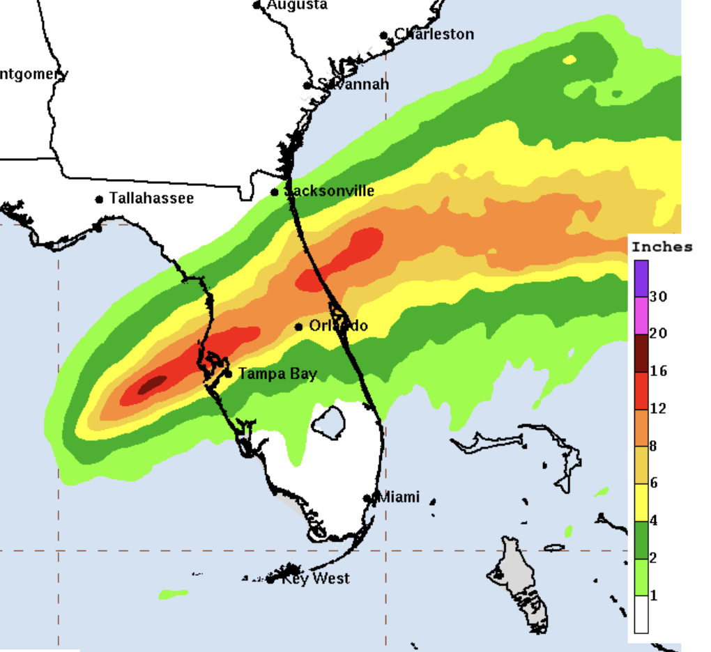
More than a foot of rain will fall causing severe flash flooding and flooding on major rivers.
The rash of tornadoes that has occurred today will continue into this evening and overnight.


Comments
Post a Comment