Attention Farmers: Central and Southern Great Plains
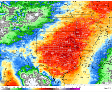
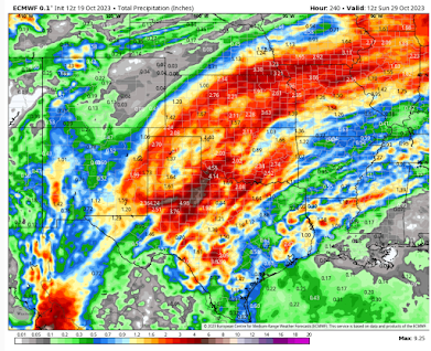
The image above is a National Weather Service average rainfall from all of the computer models with the exception of the high resolution ECMWF model, which is the single most accurate model in the world. The output from that model is below.Please note the 8" maximum amounts in Texas. One problem with the averaging process it that it smooths out the maximum amounts. I wouldn't be at all surprised to see that much fall in spots as Mexican tropical systems (what will be left of Norma) are usually prolific rainfall producers. However, exactly where those rainfall maxima will be is indeterminate at this time.
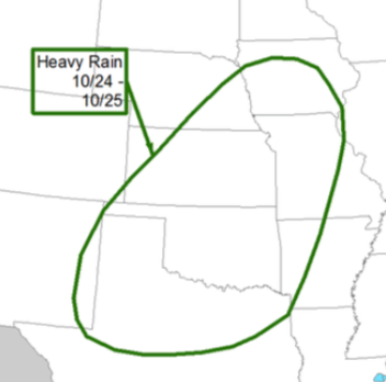
The NWS summarizes the situation this way.
Given the drought conditions in much of the area, the rain will be greatly welcomed for the 2024 winter wheat crop.However, I would recommend that fall harvest be sped up, where possible, because the areas of heavy rain may damage crops or make it difficult to get into the fields for an extended period of time.


Comments
Post a Comment