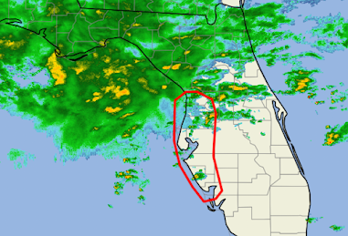
10:45pm Florida Tornado Risk Update
The area outlined in red is where tornadoes are most likely between now and 12:15am. This will be the last update of the night.
The forecast is pretty much unchanged.
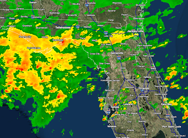
--- Original 8:55pm Post Below ---
Radar as of 8:50pm shows a large area of thunderstorms that will move from the southern Panhandle into the Peninsula overnight. The thunderstorms most likely to cause tornadoes will be part of this weather system.
Make sure your weather radio, weather apps, the WEA option on your smartphone and -- preferably -- more than one of those is active tonight.
I am providing additional information on Twitter @usweatherexpert.


Comments
Post a Comment