5:10pm Hurricane Lee Update
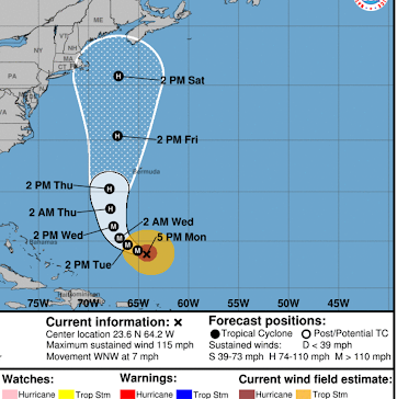
Here is the National Hurricane Center's 5pm Forecast for the Path of the eye of Lee.
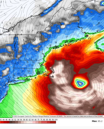
While the eye path is of interest, this storm will be like Sandy and will have a broad wind field that will not be have the highest winds near the eye like a Florida hurricane.
The above map is for illustration purposes but it shows how wide the wind field is forecast to be. But, especially, no place other than New England will have a chance of experiencing the high winds.
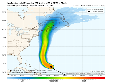
As to the position of the eye (center) of the storm, here is the latest probability forecast.
Again, there is no chance of anyone except New England experiencing the center of the storm.
I'll have a more detailed outlook later this evening.


Comments
Post a Comment