11am Update on Tropical Depression
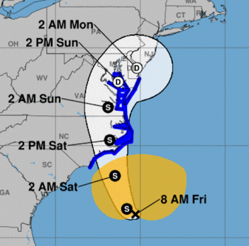
As of 10:45am, the center of the tropical depression is indicated by the "TD." It is moving north northeast and has 50 mph sustained winds. It is forecast to reach peak intensity tonight with winds of 65 mph. It is not forecast to reach hurricane intensity.
Here is the forecast path. However, please note: the amber is the field of winds of 40 mph or stronger. The strongest winds are not concentrated around the center.
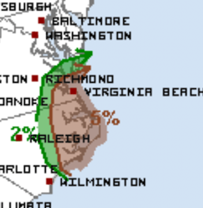
Between now and 8am Saturday, there is a good chance of a few tornadoes in the brown area.
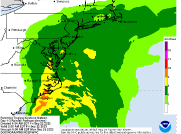
Localized flash flooding is possible with the heavier rains.
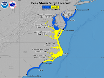
Combined with the flooding from rain, there will be a coastal storm surge with this system.
While I do not expect the forecast to change much, I'll have an update this afternoon.


Comments
Post a Comment