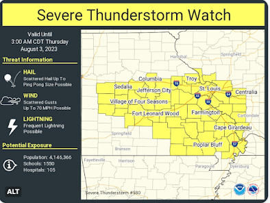
HIGH Flash Flood Risk: Eastern Missouri + Severe Thunderstorm Watch
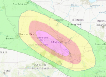
There is a rare high risk forecast of additional flash flooding, with serious flash flooding possible, tonight in eastern Missouri (where rivers are already rising) and southwest Illinois. Here is the flash flood forecast area for tonight through 7am Thursday.
Included in the high risk (purple) are Columbia, Jeff City, Rolla and the west and south parts of the St. Louis Bi-State area. Update: 8pm.
It is going to be a very rough night. Whatever you do, do not try to cross flooded areas by foot or by car. If you live in a low or flood-prone area, prepare a "go kid," essentials you can grab at a moment's notice as you drive to higher ground.


Comments
Post a Comment