Dangerous Travel Conditions - People Reportedly Stranded
-- Note, more current info available. Scroll up. ---
Updated Information as of 8am PDT
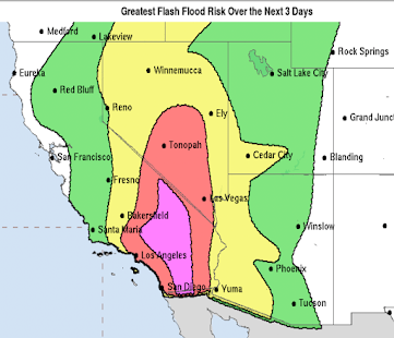
You are risking your life if you attempt to travel through the purple area.
While the rain has not begun in coastal California, I would urge you to use this time to make any preparations. Power outages have occurred already in southeast California.
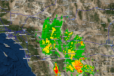
Here is the latest radar as of 7:55am PDT.
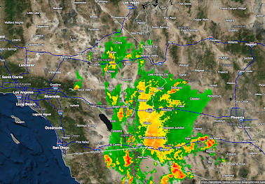
As of 6:40am PDT, the radar indicates moderate to heavy rain falling over desert areas of Southern California and far western Arizona (click to enlarge).
Rainfall amounts for the 24 hours ending at 7am PDT show more than two inches have already fallen.
There are reports from reliable sources that roads are already washed out and that people are stranded in isolated parts of the desert.
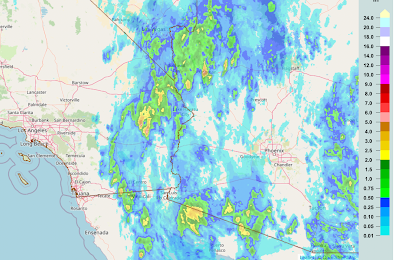
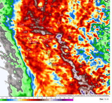
Below is a high-resolution computer model's rainfall forecast from 5am PDT to 11pm PDT Sunday.
More than a foot of additional rain is forecast to fall. This will lead to catastrophic flooding.
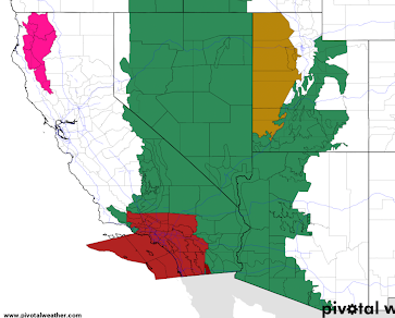
Here is a map of current watches and warnings.
Here is the color code:
- Red = tropical storm warning.
- Magenta (northwest California) = wildfire danger.
- Green = flash flood watch
- Gold = high wind watch
It is worth noting that if you live west of The 405, the rains and resulting flooding -- if any -- should not be as serious as farther east.
 |
| Click to enlarge |
Conditions will worsen for California through tomorrow night.



Comments
Post a Comment