9:40 pm EDT Special Update: Idalia, A Bit Stronger
[Scroll up for more current information. Thank you.]
I want to update you before your retire for the night.
As of 9:40pm, trends continue in the wrong direction.
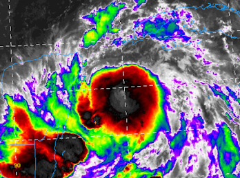
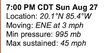
- The inner core development (immediately below) continues. A nearby buoy is measuring rapidly falling barometric pressure. This strongly implies that strengthening is occurring more quickly than forecast.
- Two more ensembles of models have come in and they, too, forecast a path a little farther to the east.
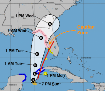
Given the above, it would not surprise me if hurricane warnings for the west coast of Florida and/or western Cuba were issued later this evening. Regardless, it is absolutely essential for those in the hurricane watch and the caution zone (below) to prepare for the potential (not certainty) of major hurricane conditions.
[ --- original text, still valid ---]
I don't like the trends I am seeing with Idalia. Satellite seems to be showing the storm developing an inner core a bit sooner than expected (circle).Second, as far as I can tell, every one of the reliable computer models from their 1800 hour UTC runs has again nudged the forecast path farther to the east. This is why in every post, since my first on the 23rd, has included the possibility of a path farther east than some others have forecast. Note: it is not certain that will occur. But, it is concerning because it would bring the higher winds closer to the Tampa Bay area.
It is vital that everyone in the hurricane watch (pink) consider themselves at potential risk of major hurricane winds and storm surge.
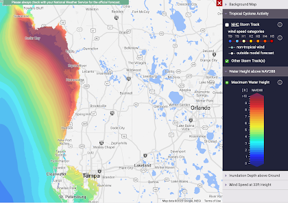
With regard to storm surge, here is the latest forecast.
Please note the already forecast significant surge in Tampa Bay. Second, the surge is forecast to be ~12 feet farther north. Tornadoes will accompany Idalia in Florida.
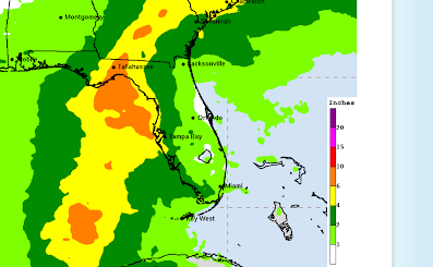
Heavy rains likely, flooding possible.




Comments
Post a Comment