Today's Tornado and Derecho Risk: Kansas
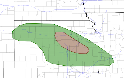
Kansas has not experienced a derecho in a decade. They are concentrated lines of thunderstorms that cause widespread destructive winds in their paths. One is possible today.
It includes Salina, Marion, El Dorado, northeast Wichita and Eureka.
Damaging winds will likely sweep across the eastern half of the state.
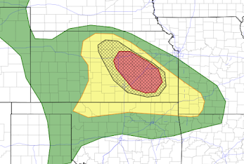
The yellow area has a significant risk of wind gusts above 60 mph. The red area has an enhanced risk. Where you see the hatching, wind gusts of 75 mph or stronger are forecast to occur. One of the models forecasts a peak gust of 93 mph in the hatched area. These winds can be highly destructive and cause power failures along with considerable damage. These thunderstorms will also be accompanied by considerable large hail which will also be destructive.
Safety Measures:
- Put your car in the garage but, first, fill it will fuel as power may be out.
- Stow lawn furniture and other items that can blow about.
- Make sure your family members and friends are aware of the risk.
- Put family heirlooms in your shelter area.
AS of 10am:
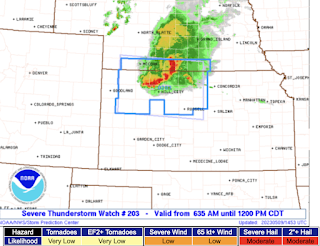
A severe thunderstorm watch is already in effect in southwest Nebraska and northwest and north central Kansas until noon. Considerable hail is already occurring.
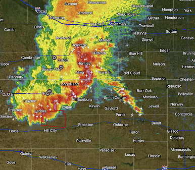
Radar at 9:58a, shows the line of thunderstorms. A tornado warning is in effect in the red polygon.
If you live in the eastern two-thirds of Kansas, please keep up on the weather throughout the day!


Comments
Post a Comment