Tornado Path Maps for Delaware, New Jersey, and Maryland
The NWS SPC made a superb tornado forecast for late today (see posting below). Congratulations to them for three days of great work! As forecast, there were several tornadoes in the Middle Atlantic Region this evening. Here are the path maps.
Delaware
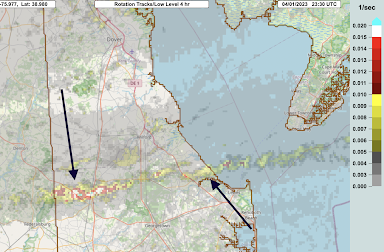
A tornado crossed the width of Delaware. We are getting reports of one fatality and considerable damage.
The arrows denote the path. The strongest rotation was in western Delaware. The closeup indicates the worst of the damage (based on strength of wind rotation) was likely between Bridgeport and Greenwood. The airport (airplane symbol) clocked a wind gust of 98 mph.
New Jersey
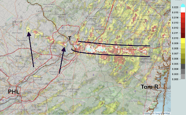
I've marked the position of Philadelphia, Trenton (T) and Toms River. The path of the possible tornado begins at the left arrow and it appears to have been non-continuous until it crossed the river.
Southeast of Trenton, we apparently had a significant tornado (blue/white colors) that moved east to early the coast. Note: the lines are to help focus your gaze away from the interference.
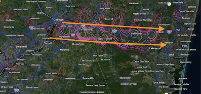
Finally, here is another view. Of course, the tornado was not the width of the orange lines. It is just, on a preliminary basis, this as close as we can get. I want any first responders to be able to use this to get into position.
Maryland-Delaware
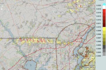
There may have been a tornado just south of the Pennsylvania-Maryland border that weekend as it moved into northern Delaware.
ADDITION: News story from NBC 10 in Philadelphia, here.


Comments
Post a Comment