Recap of Yesterday's Storms
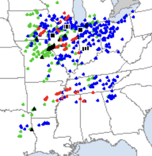
As of 9:45am, here is a plot of tornado (red), damaging thunderstorm wind (blue) and hail 1" or larger (green) reports.Given the intensity and number of tornadoes, the preliminary death toll of 10 -- while a tragedy for everyone close to the victims -- is a miracle of weather science. The forecasts and warnings saved dozens of lives.
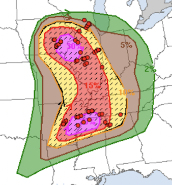
How good was the tornado forecast? Here is the National Weather Service's Storm Prediction Center's forecast that was presented on this blog late yesterday morning. The dots are tornado locations (there will be more tornadoes added as post-storm surveys proceed).
The hatching indicated that "strong" tornadoes (F-2 or stronger) were forecasted. That forecast also verified. There are many spectacular tornado photos here.
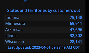
Customer = 1 home or business. The numbers represent, roughly, 700,000 people without power.
Weather science did an amazing job yesterday. SPC = NWS's Storm Prediction Center.
Unfortunately, there is more to come the first of the week.


Comments
Post a Comment