California Flood Forecast Update 1:45pm PDT
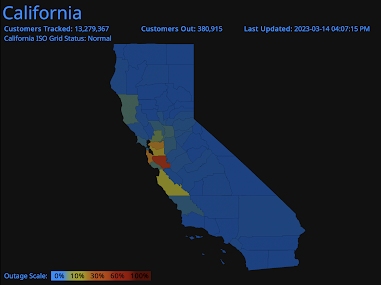
Power Outages as of 2:07pm PDT
The high winds (a gust to 71 mph at the San Francisco International Airport) are causing power failures and major flight delays. As of this moment, the flight delays 2.6 hours.
Addition at 2:38pm.
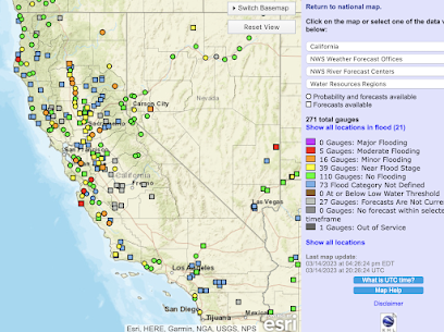
Flood Forecast for Major Rivers
The red squares are where "moderate" flooding is expected on major rivers. If you live anywhere near the red or orange squares, you can go here to receive the detailed flood forecast.
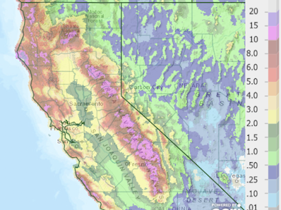
Below is the 7-day precipitation ending at 5am this morning.
Please note the 20" total (white) over the coastal range near Eureka. There are numerous areas in the Sierra where more than 15 inches have fallen.
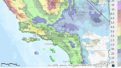
Southern California Precipitation
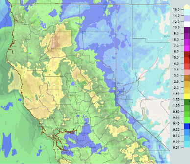
Above the the precipitation for the past five days ending at 5am. Here is the precipitation that has fallen since.
UPDATE: As of 3pm, the Los Angeles office of the National Weather Service says the storm has been "underperforming" so far. In the City of Los Angeles, amounts to this point have been between 0.25 and 0.33 inches.
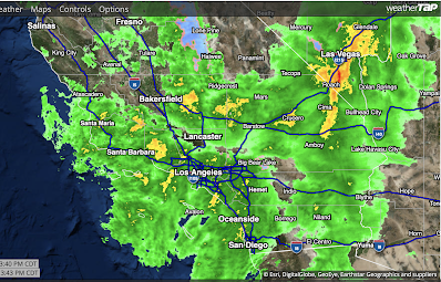
Current Radar
Below is the radar from 1:44pm PST.
The heaviest rains in the state are now in the Southland. In northern California, the rains are starting to taper off. 




Comments
Post a Comment