Ice Storm Warning!! [Updated for Eastern Great Lakes]
Note: Based on the models through 10:45pm, this forecast, as amended for eastern forecast area (below) still looks good. I recommend that people in the Detroit metro, especially northern areas, check the latest forecasts tomorrow morning.
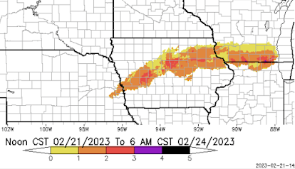
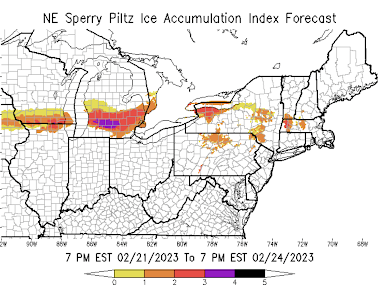
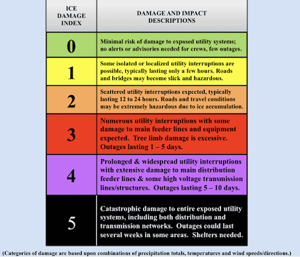
Here is the Sperry-Piltz ice storm index. It was highly accurate during the recent Texas ice storm, especially in the Austin area. Click to enlarge. More below the table.
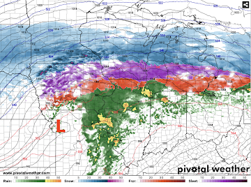
Here is the forecast radar for 7pm EST. Purple is sleet. Red precipitation is freezing rain.
Here's how to prepare:
- Get cash from the ATM.
- Fill your car with fuel, especially if it is an electric car.
- Make immediate provisions for infirm friends or relatives.
- Refill important prescriptions now, if they are running at low. Pay special attention to insulin or any other drugs or foods that must be refrigerated.
- If you have a chain saw, check the fuel level.
- Make provisions for heating your home, safely. Do not try to heat your home with a flame anywhere except in the fireplace. People died while burning their homes down in Austin the ice storm 2 years ago.
- If you purchase a generator, keep it well away from air intakes due to carbon monoxide risk.
- Put cars in the garage in case of falling limbs.
- Do not touch downed power lines. They may still be energized with an electrocution risk.
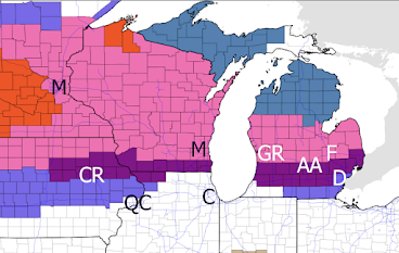
Finally, here is a map of National Weather Service ice storm warnings (purple) as of 3:20 C/4:20pm EST.
I will update the ice storm forecast late tomorrow morning. At that time, I will cover the potential for freezing rain in Pennsylvania and New York.
Please prepare in the meantime!



Comments
Post a Comment