Fast-Moving Midwest Storm
This is the storm that will produce tornadoes and damaging winds tomorrow afternoon into Monday night in the Great Plains and will also produce another damaging ice storm in the Great Lakes region.
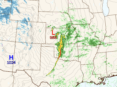
Forecast for 8pm Sunday
 |
| PolarWx |
There will be very high winds of more than 70 mph in west Texas Sunday afternoon. The squall line in Oklahoma and, possibly in Kansas, is forecasted to produce damaging winds of more than 80 mph along with tornadoes.
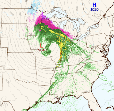
8am Monday
The purple is freezing rain. It will likely accumulate sufficiently to cause power failures. See additional info at the purple link above. High winds will accompany the low from the Dakotas to the Ozarks as well as around the Great Lakes.
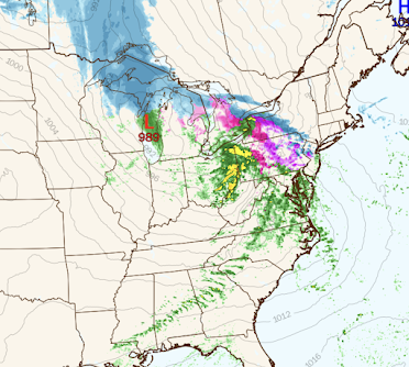
6pm Monday
The rain will change to snow in western Ontario, Upper Michigan and Wisconsin. The freezing rain will move from the thumb of Lower Michigan into Pennsylvania. High winds will gradually move east. Where the light brown lines (isobars) are close together, high winds are likely.


Comments
Post a Comment