9:40pm Update on Winter Storms
[note: there is a newer forecast, please scroll up on the blog]
9am Tuesday
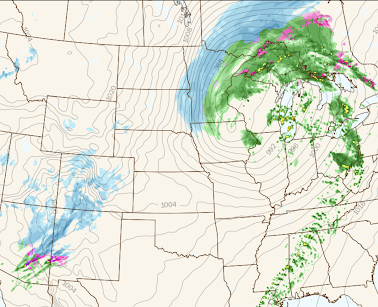
5pm Tuesday
In the afternoon, temperatures will have warmed sufficiently that storm #1 will be mostly rain. Winds will rapidly be increasing over the Dakotas.
2am Wednesday
At night, the rain will have changed to snow (blue) with gusts of 40-50 mph and blizzard conditions over the far eastern Dakotas and much of Minnesota.
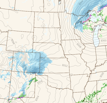
10am Wednesday
The first storm will be exiting over Lake Superior and Ontario while storm #2 emerges into the central Great Plains.
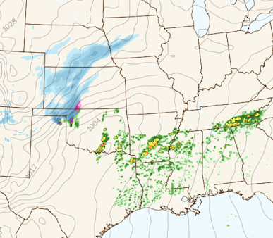
5pm Wednesday
In addition to the snow developing and increasing, severe thunderstorms are forecast to develop in southern Oklahoma and Arkansas. There may be some drifting in southwest Kansas and the Oklahoma Panhandle.
11pm Wednesday
Severe thunderstorms are in progress from northeast Texas into Arkansas and, perhaps, northern Mississippi. Heavy snow is likely in central Kansas with some freezing rain possible in the Flint Hills. The snow will be spreading into Nebraska and Iowa.
Total Snowfall
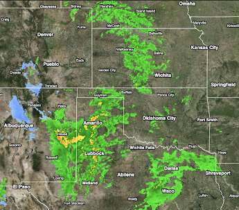
Initial Radar
The radar at 9:40pm is below. Needed rain was breaking out in the central and southern Great Plains.


Comments
Post a Comment