4:30pm Monday: Updated Snow Forecast Amounts Now Until 6pm Thursday
[More current forecast available. Please scroll up.]
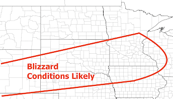
Blizzard conditions are likely in the north central United States.
It is absolutely essential that you plan for these conditions if you live in the region, are planning air travel or are planning surface travel.
This is what I-29 looked like two weeks ago in a lesser blizzard. Many people spent the night.
This storm will be worse! You don't want to trapped in the middle of nowhere. Snow Amounts
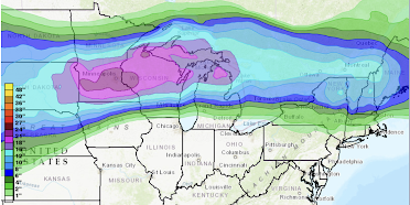
Here are the forecast snow amounts from 6pm this evening to 6pm Thursday.The snows will be accompanied in many areas by gusts of 40 mph or stronger.
Addition: NWS in Minneapolis says there is an 83% chance of more than 18 inches of snow!
Extreme Cold Will Accompany the Snow
Record cold will accompany the snow making this a truly life-threatening situation.
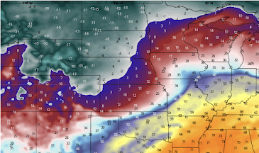 |
| Forecast temperatures for 10am Thursday |
 |
| Forecast wind chills for 10am Thursday |
It is vital that people in the region prepare for this storm.




Comments
Post a Comment