Ice Storm and Cold Wave Updates
Cold Wave Forecast
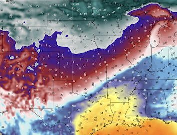
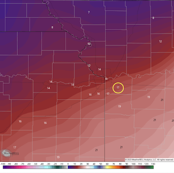
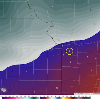
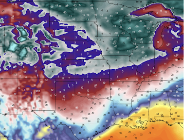
Above are the forecast temperatures for 6am Sunday. Double-digit below zero temperatures (these are not wind chills) in the northern Great Plains. If you are one of the 76,000+ going to the Bengals - Chiefs game, the 6pm temperature (top) and wind chill maps are below. I've circled the forecast that is technically for the Lee's Summit (suburb) airport but it is near Arrowhead. The forecast temperature in the first half should be 17°F with a wind chill of
5°F.
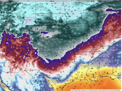
By Tuesday at 6am, the Arctic cold air mass will have reached the Gulf and the below zero low temperatures will have pushed as far east as Indiana.
Ice Storm
While I am pretty good at forecasting ice storms without models at about 24-30 hours, beyond that, it is important to use the models. And, there is an extraordinary spread in their forecasts, still. So, what I am doing is taking a pretty reliable blend of models and presenting them here so that people in the affected areas can prepare.
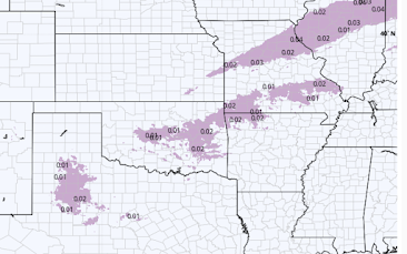
Noon Monday
The freezing rain and freezing drizzle is just starting.
Of course, I will continue to update the blog and I always have updated info on Twitter @usweatherexpert.



Comments
Post a Comment