California: Another Major Storm
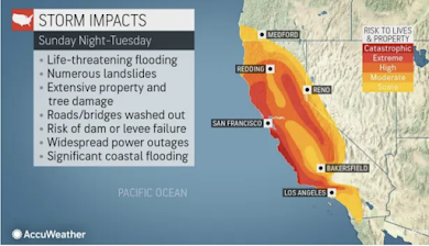
We have another major storm coming into California and this is more likely to have serious effects on the Southland as well as the central and northern parts of the Golden State.
So, by any standard, this is going to be a major storm. Please consider the following suggestions:
I'm going to break it down for you as to storm timing and intensity:
Storm Arrival
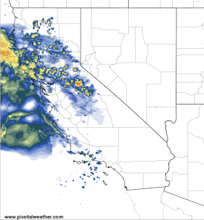
Below is the forecast radar for 8am PST Monday.
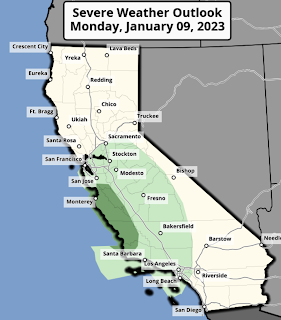
Note that heavy, wet snow will be falling over the Sierra. From this point, the storm will trend south into Southern California. From 7am Monday to 4am Tuesday: There is a good chance of thunderstorms in the light green area and, in the dark green area, a risk of tornadoes.
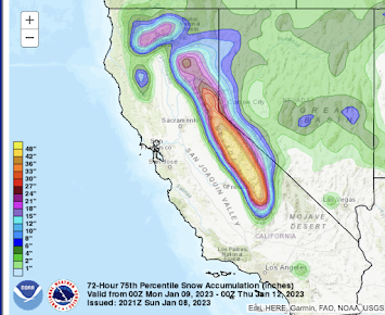
3-Day Snow Amount Forecast
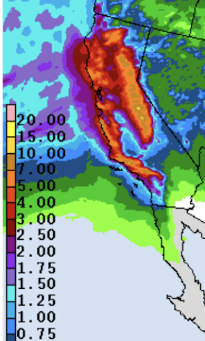
This storm is literally "off the chart" as the maximum 3-day accumulation it will plot is 48 inches. It would not surprise me if three day snow amounts exceed 60 inches in places! I'm nearly certain I-80 between Reno and Sacramento will be closed. 3-Day Precipitation Amount Forecast
This represents the rain and the amount of moisture in the snow in inches from now until Wednesday evening.
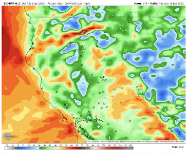
Note the 7 inches of precipitation forecasted for Mt Wilson and 5+" elsewhere in the Southern California mountains. Peak Winds
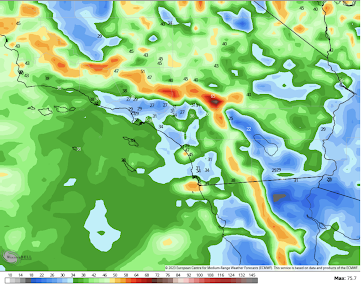
Here are the forecast peak wind gusts during the next three days.
The above is for the next three days.
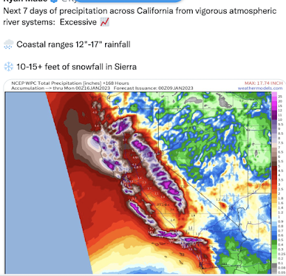
Ace forecaster Dr. Ryan Maue just posted this for the extended period.
 |
| click to enlarge |
- Fuel your car now before the storm arrives.
- Get extra cash at the ATM, as they may or may not work if the power fails for a long duration. If you are an employer, get enough money (if you can) to give small amounts to your employees if they should get in a bind.
- Allow your team to work at the office or home (their choice), wherever they feel most secure. Allow them to bring sleeping bags, etc., buy some food (water bottles, energy drinks, non-perishable foods, etc.) and diapers.
- Monitor the river forecasts in your area if you are within a mile or so of a river.
Whatever you do, do not walk or drive into a flooded area. The vast majority of flash flood deaths are of people who were safe voluntarily driving into flooded areas.




Comments
Post a Comment