9:50am CST Winter Storm Update
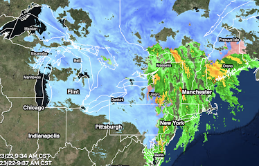
The major storm is causing havoc to transportation and to the general public as it has moved east.High winds are occurring throughout New England. Burlington has recorded a gust to 70 mph, the second highest gust ever recorded at that weather station.
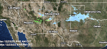
Finally, there are areas of snow and rain in the Southwest that are affecting I-40 and branch interstates such as I-27.
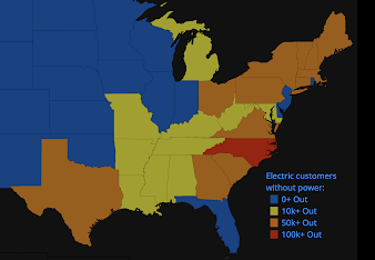
A map of the current power outages is below.
I have gone to the FAA's web site and it should be assumed that all of the areas showing rain or snow on the radar have significant delays. Of course, these delays cascade through the system. If you are trying to fly today, I would urge you to go online (don't try to call) and check the status of your flight. According to the news media, 3,000 flights have been cancelled.
The West isn't without troubles.
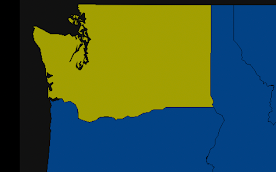
Because of the mountains, the radar algorithm is having issues with precipitation type in Washington. There are more areas that are receiving freezing rain (pink/orange) than shown. There are power outages as a result. National Weather Service winter storm warnings and advisories.
Color codes for winter storm info:
- Orange = blizzard warning
- Pink = winter storm warning (for snow in the East and for ice in Oregon and Washington)
- Dark green = winter storm watch
- Purple = winter weather advisory (a lesser condition than a warning)
- Gold/Brown = high wind forecast
- BlueGray = extreme cold warning
- Purple = ice storm warning
We are at the point where the storm has transitioned into a news story, so I am going to discontinue my comprehensive coverage which began on December 8. Modern meteorology has become a powerful tool for society at large and business, in particular, when properly used.
Addition for Canada


Comments
Post a Comment