7pm Cold Wave and Winter Storm Warning Update
The basic weather pattern we have been watching has not changed.
An extremely dangerous cold wave and winter storm is going to develop in the next 72 hours for the Lower 48 to the east of the Rockies.
As of 7pm Monday, here is new information based on data through this evening with regard to snow
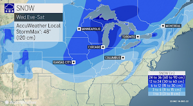
AccuWeather published this map within the past hour. It is the total snow forecasted with this storm.
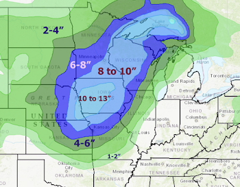
I used the method I've often used with other winter storms and came up with the amounts below.
This map is valid from tonight through 6pm Thursday. The band from Kansas to Lake Superior will fall Wednesday through 6pm Thursday. With the high winds, there will be blizzard conditions with considerable drifting snow. Many roads, including interstate highways, will be closed. Given the extreme temperatures and the fact that first responders will be overtaxed, there is a real chance of injury or death if you should become stranded in a remote area. -- original posting, 2:45pm Monday --
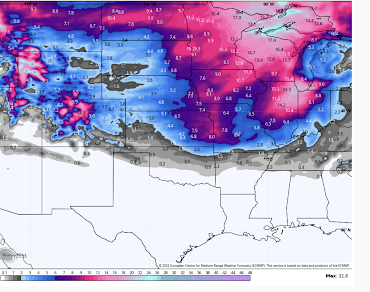
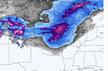
Snowfall From Noon Wednesday to Noon Thursday
Snowfall From Noon Thursday to Noon Friday
Total Snowfall From Noon Wednesday to Noon Friday
 |
| Click to enlarge |
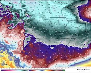
Temperatures will be extraordinarily cold.
Wednesday, 6am
Friday, 6am
Wind Chills at noon Thursday
Wind Chills at noon FridayIn addition to the dangers to health from the cold itself, there are several other issues:
- Bursting pipes
- Power failures
- Natural gas shortages
- Traffic accidents or getting stranded.
Here's how to mitigate some of the issues:
- Complete Christmas travel before the Siberian air arrives along your route and at your destination. If you are traveling by air, move up your departure.
- Get cash (ATM's don't work without power) and fill your car with fuel. Get important prescriptions refilled.
- Make sure you have "ice melt," sand or kitty litter to spread on driveways, sidewalks and porches for traction. It doesn't melt anything with temperatures of zero, but you will appreciate traction of you have snow and ice.
- If you have an infirm friend or relative who may need help, move them in with you before the cold air arrives.
- Public officials should make provisions for the homeless.
- Disconnect garden hoses! Turn on a small stream of water, flowing water is less likely to freeze. It will be nearly impossible to get a plumber if burst pipes are widespread.
- Do not use blow torches to unfreeze lines!
- Open the cabinets near where the water comes into the kitchen.
- Know where the water comes into your home and how to shut it off. If pipe(s) burst, turn off your water as quickly as possible.
- Keep your home's thermostat at the lowest possible level for your comfort to conserve energy. Wear sweaters and extra clothing. Use UL Lab-approved space heaters, if necessary.





Comments
Post a Comment