Tropical Storm Nicole 10am Update
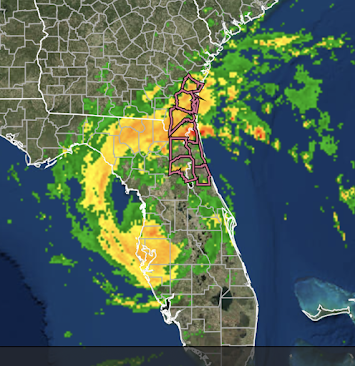
This is the 9:50am radar image of Tropical Storm Nicole. The highlighted counties are under a tornado watch.
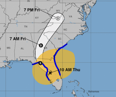
Maximum sustained winds are 50 mph with a pressure of 984 millibars. Below is the forecast showing the storm as it weakens over the next three days.
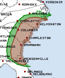
A prediction of tornado risk the rest of the day.
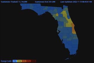
The brown area has a significant risk of tornadoes until 8am Friday.Power is out in much of the northeast peninsula.
- S = tropical storm
- D = tropical depression
- D = post tropical low pressure system
The amber area is where tropical storm force winds are occurring.


Comments
Post a Comment