Unfortunately, the Worst Is Coming to Pass - Updated 12:55pm
This is a catastrophic situation. Ian is "on the threshold of Cat 5 intensity" (National Hurricane Center quote)
Ivan has winds of 155 mph. Last night's forecast still looks accurate.
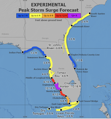
This is life-threatening, horribly dangerous surge.
The area from Tampa to Naples to Orlando/Disneyworld will see life-threatening conditions as hurricane-force winds cross from the Gulf to the Atlantic.
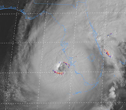
As of 11:20am, based on the Doppler radar data aloft reduced to sea level, I believe we have Cat 5 hurricane with wind speeds of 160-165 mph. It is impossible to overstate how dangerous this storm is as the lightning (+ symbols) indicate that the storm is still trying to intensify.
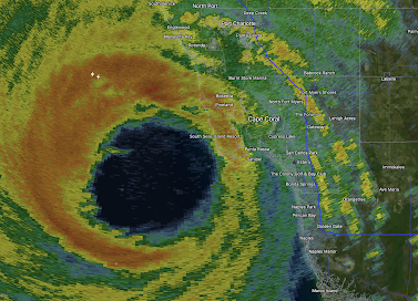
Below is the radar at 12:20pm. The eyewall of Ian is over Sanibel and Captiva. Twenty minutes ago, the wind gusted to 98 mph at Sanibel. Winds have only increased since then.
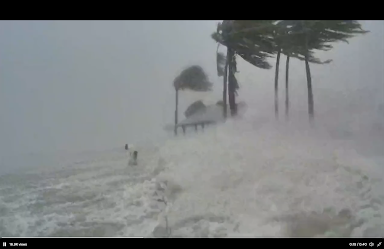
This photo was taken by cyclonePORT on Sanibel as the storm surge covered the island.

10:54 am radar. The lightning indicates the storm is still trying to strengthen. Its winds at this time are still 155 mph. The arrows denote
Hurricane-force winds (75 mph) are now reaching Sanibel Island.
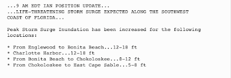
See the graphic below for the area of highest storm surge, which may reach 20' in spots. This graphic will assist you in visualizing the severity of the storm surge: https://twitter.com/efisherwx?lang=en
Please see the post below for additional critical information.
-- Original Posting --
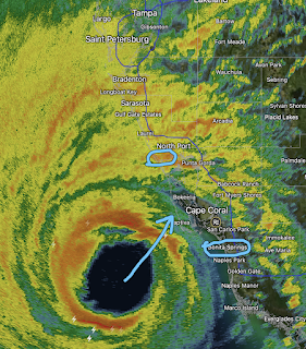 |
| 9:46am EDT radar I have circled Englewood to Bonita Beach |
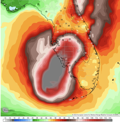
Below is the forecast wind swath:
Current sustained winds are officially 155 mph with gusts above 165 mph. Cat 5 is 161 mph sustained winds. 173,000 homes and businesses are without power. This equates to ~400,000 people. The satellite below is from 9:57am. The lightning surrounding the eye indicates that the storm may in fact intensify further.
There will be severe freshwater flooding. The worst will be in the purple but it will be severe in the red area as well.
Outlook
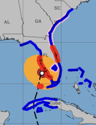
As shown above, the hurricane-force winds will cross the Florida Peninsula and regenerate when they reach the Atlantic. A second landfall is forecast by NHC to occur in Georgia or South Carolina.
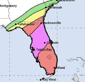
Here is what the colors mean:- Red, hurricane warning.
- Pink, hurricane watch
- Blue, tropical storm warning
- Brown = hurricane-force wind area as of 11am ( ≥75 mph)
- Amber = ( ≥ 40 mph)
Please closely monitor the weather in these locations.




Comments
Post a Comment