My Forecast for Hurricane Ian's U.S. Landfall
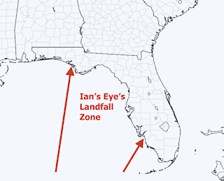
Based on the latest data, I think I can narrow the location of landfall of the eye of what is forecast to be Hurricane Ian when it gets to Florida.
Note that this forecast differs a bit from the National Hurricane Center's forecast in that it includes areas to the east and south toward Ft. Myers.
Here is an important point: the farther south Ian makes landfall, the stronger it is likely to be. Also, the farther south, the sooner it will make landfall because of the shorter distance it will have to cover.
Tomorrow, I hope to narrow the zone further and provide you with a band showing the wind speed pattern associated with the storm.
Note: the NWS's forecast of flooding rain (below) looks be absolutely correct.
As of 8pm, the storm had strengthened since the 4pm CDT advisory: winds are now 60 mph and surface pressure is down to 991 millibars.
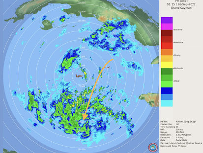
Update at 8:20pm CDT based on brand new data from a Hurricane Hunter aircraft: The surface winds are now about 65 mph and the pressure is 987 millibars. Ian is rapidly strengthening. The center of the storm is at the tip of the arrow as seen from the Grand Cayman radar at 8:15pm CDT.


Comments
Post a Comment