UPDATE: Dangerous Tornado Situation in the Midwest
We have a dangerous tornado situation in parts of Iowa and Illinois this afternoon and tonight.
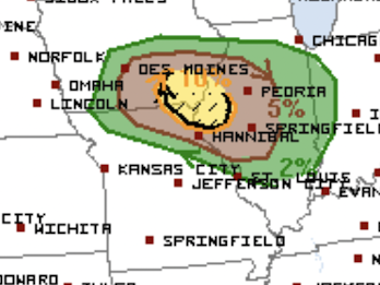
The NWS has moved the higher risk areas a bit to the south.
The yellow, hatched area has an enhanced risk of strong tornadoes. Galesburg, Iowa City, Ft. Madison, and Ottumwa.
The brown area has a significant risk of tornadoes. It includes Des Moines, Peoria, Quincy and Cedar Rapids.
Note: I don't think there will be dangerous storms before 5pm. However, starting in late afternoon, you should be following the local weather closely. I will be supplementing that coverage on Twitter @usweatherexpert.
Because it has been months since we have had a major tornado risk, let's review preparation procedures:
- Now is the perfect time to sign up for our tornado alarm called StormWarn.
- Clear out your shelter area now. Make sure it has a flashlight, a couple of bottles of water, a radio or television, and diapers if appropriate.
- Always wear shoes into your shelter. If your home is struck, exiting the shelter in bare feet could be dangerous.
- Bring in trampolines, lawn furniture and other things that can be blown about.
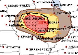
Very large hail is also likely in this region, so put your car in the garage. The hatched area is where hail larger the 2" in diameter is forecast to fall. The 30% area (red) is a relatively high risk.


Comments
Post a Comment