5:15pm Ian Update
Update with 4pm Data
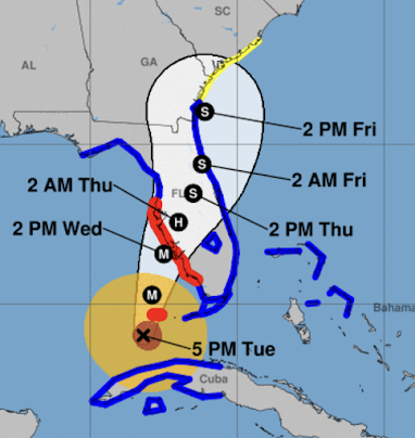
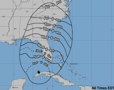
This is the National Hurricane Center's 4pm forecast. They finally extended the hurricane warning south to Everglades City.
There is now a storm surge warning and tropical storm warning along the Atlantic Coast from Georgia through South Florida.
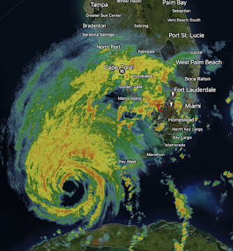
Here is the radar image of the eye of the hurricane at 5:13pm CDT.
I believe the information below is still good except that it is a bit more likely the wind swath map needs to be moved south.---- original posting ---
Current Situation -- 2:15pm
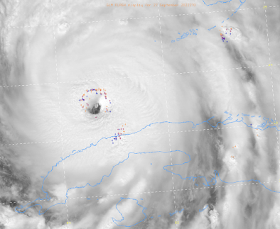
2:01pm satellite image. They Keys are at upper right in blue.
This is the eye of a powerful hurricane and the colored symbols denote lightning around the eye -- which is a sure sign of additional strengthening. Its current wind speeds have increased to 120 mph (conservatively) with a central barometric pressure of 955 millibars. The storm will continue to strengthen as it approaches Florida.
Forecasts
I believe the wind speeds will reach 140 to 150 mph in the storm and the storm will be at least Cat 3, more likely Cat 4, at the time of landfall. Right now, the eye looks like it will pass south of Tampa Bay but it would take only a slight chance for it to pass over or to the north.
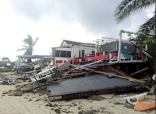
Wherever the eye makes landfall, conditions will be life-threatening with great destruction to the south. The damage may look something like this:
These are the times by which your precautions should be finished.
Wind Pattern
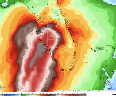
Here is a reasonable depiction of Ian's wind field. Note: it could move north or south 30 miles or so. This is going to be a powerful hurricane - at least Cat 3 - at landfall. Note: not shown is higher winds toward the Georgia coast. We'll discuss that in the next update.
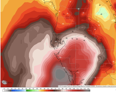
Below is a closeup of the above wind pattern for the Tampa Metro. Again, this could easily shift 30 miles or so to the north or south. Do not take it literally.
Sarasota, Venice, Punta Gorda would be in the area of highest winds if this should be a perfect forecast. Storm Surge
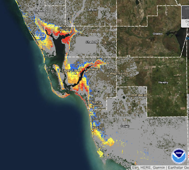
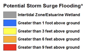
This will be a life-threatening storm surge! The highest surge is usually to the south of the eye of the storm.
For the red area above, here are more details.
Again: This is a life-threatening storm surge! Get out! Remember, the surge forecast does not include the high waves on top of the surge. There is a serious risk of tornadoes. Details here.
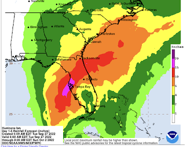
Dangerous freshwater flooding is likely.
My next update will be late this evening.






Comments
Post a Comment