9:05 pm EDT Update on Hurricane Ian
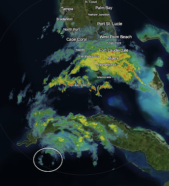
Here is the eye of Ian, which just became visible from the Key West NWS radar at 10:10pm. The thunderstorms making up the eye are just inside the white circle I added.
UPDATE: Another alarming sign. The eye is clearing out just south of Cuba and, just to the west, lightning (red/orange dots). The latter is usual a sign of intensification. Photo from 10:25pm.
-- original post --
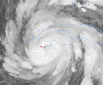
Below is the 8:54pm Ian satellite image.
The above satellite image shows a strengthening hurricane with a central pressure down to 965 millibars. The maximum winds are around 105 mph. The strengthening may level off as Ian approaches western Cuba. Once it has cleared the Cuban land mass, I expect rapid strengthening and that the National Hurricane Center's 140 mph peak wind forecast to occur.
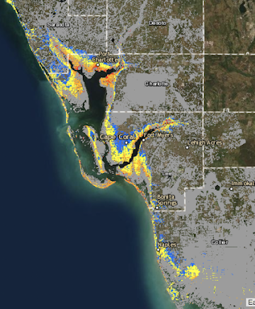
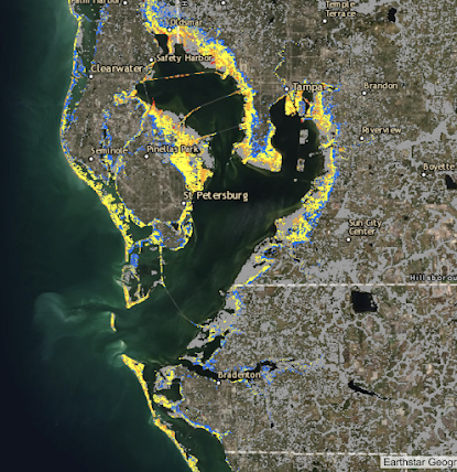
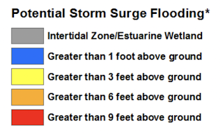
Please note that both maps have areas where the storm surge are forecasted to attain heights of 10 feet or higher. This would be extremely destructive. There are some models that are stalling Ian near Tampa Bay. That would mean somewhat higher water levels than shown here and would cause catastrophic conditions in the Tampa metro.
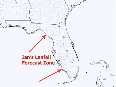
My forecast of where the eye will cross the coast is below.
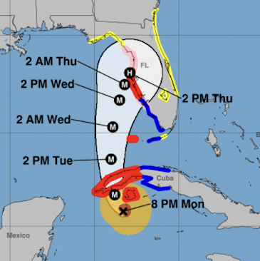
The National Hurricane Center's 3-day forecast is below:
- Red = hurricane warning
- Pink = hurricane watch
- Yellow = tropical storm watch
- Blue = tropical storm warning
- Amber = tropical storm force winds now
- Brown = current hurricane force winds
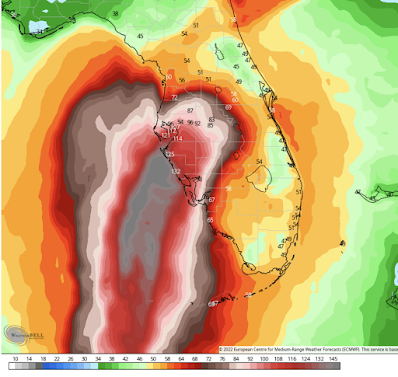
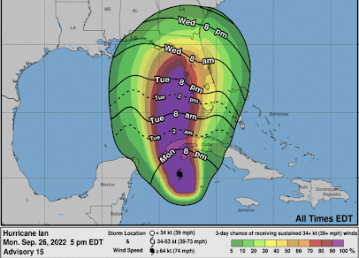
This evening, the models continue to trend a little farther to the east. This looks reasonable as the maximum wind swath but keep in mind it could shift a little to the north or south.
This is the time by which your preparations should be completed -- this includes evacuations where appropriate.
Given the National Hurricane Center's forecast path, below are the forecast storm surge maps. Note that this does not include the high waves that will be generated on top of the surge.
 |
| Tampa Bay Inundation Map, click to enlarge |
 |
| Naples to Sarasota Inundation Map |
Tornadoes are forecasted to occur. See this posting.
And, flooding rains are likely across Florida and the Southeast.
Of course, I will update tomorrow morning. I'll also update later this evening if things change significantly.




Comments
Post a Comment