8:10pm Hurricane Ian Update
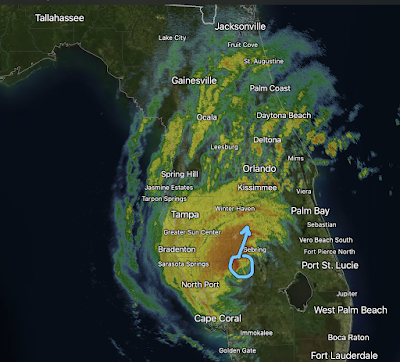
Like 2004's Charley, Ian is headed in the direction of Orlando. 8pm radar.
Maximum winds at 8pm are 115 mph with a central pressure of 960 millibars. Winds gusts to 90 mph in Charley and something similar will occur with Ian. People in the Orlando - Disneyworld area need to hunker down, now!
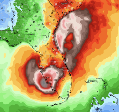
Below is a map of the predicted wind swath of Ian into the Atlantic where it will regenerate to near hurricane or actual hurricane force and then turn north threatening coastal areas of Georgia and South Carolina.
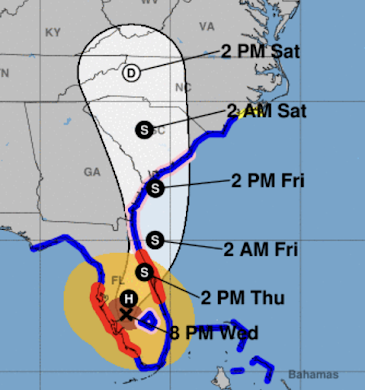
Here is the specific projected path:
Legend:
H = hurricane. S = tropical storm (> 40 mph winds)
Amber = winds stronger than 40 mph.
Brown = hurricane force winds ( ≥ 75 mph)
Red = hurricane warning
Pink = hurricane watch
Blue = tropical storm warning
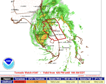
A tornado watch is in effect until 1am. The watch is the area enclosed in red.
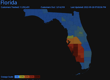
Florida is approaching 2 million homes and businesses without power. That equates to about 5 million people. The power failures were only get worse tonight and power will be out for more than a week in some areas.
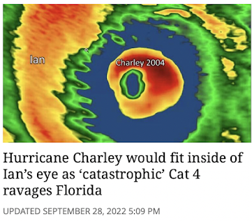
I've made many comparisons of 2004's Hurricane Charley to today's Ian. Ian has stronger winds (by 10 mph) and is far larger. The Miami Herald published the comparison below.
Neglecting inflation, the damage toll from Ian will be much more than Charley. Here's hoping the warnings saved many lives. Finally, Sunday's game may be in jeopardy.
 |
| Sports Illustrated |



Comments
Post a Comment