5:20pm Update on Hurricane Ian
Note: I have posted updates as of 5:50pm.
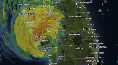
Radar image of Ian at 5:21pm.
S = tropical storm (> 40 mph winds)
Amber = winds stronger than 40 mph.
Brown = hurricane force winds ( ≥ 75 mph)
Red = hurricane warning
Pink = hurricane watch
Blue = tropical storm warning
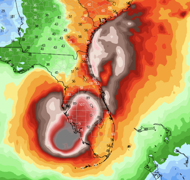
Wind Forecast
This is the peak wind forecast for the next four days. Ian is expected to cause wind gusts of near 100 mph around Orlando-Disneyworld. It will weaken a bit until it emerges into the Atlantic where it is forecast to restrengthen and make another landfall in Georgia or South Carolina.
Update: Here is a map of power failures. There are 1.3+ million customers out at this point which equates to nearly 4 million people.
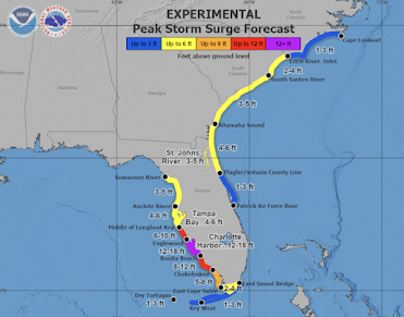
Storm Surge
A serious and possibly life-threatening storm surge is forecasted to occur across coastal areas of South Carolina, Georgia and the First Coast of Florida.
Tornado Watch
The red outline is a tornado watch until 1am EDT. The risk of tornadoes will continue throughout the night. I urge you to sign up for StormWarn to be alerted if you are in danger of a tornado at night or during the day.
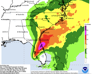
Freshwater Flooding
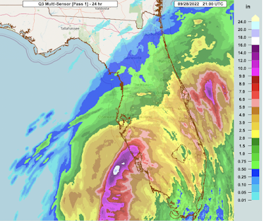
Above is a forecast of additional rainfall with this storm. Severe flooding will occur in the areas with the heaviest rain.
Below is the amount of rain that has already fallen up to 5pm EDT.
For more information: Blog, mikesmithenterprisesblog.com
And, Twitter, @usweatherexpert






Comments
Post a Comment