10am Update on Ian
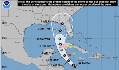
Here is the latest path forecast from the National Hurricane Center.
Because the number of miles to the coast is greater than in earlier forecasts, landfall is now expected on Friday. The area within the white outline (a/k/a "the cone") should be prepared for hurricane conditions. I am fairly confident that we will be able to more specifically predict the location of landfall and what will then be Hurricane Ian's landfall wind pattern more precisely.
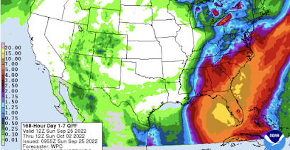
Flooding rains are likely.


Comments
Post a Comment