Attention: Young Meteorologists and Storm Chasers
This piece is intended for young meteorologists and storm chasers.
It appears the New Orleans NWS did a fine job with the warning.
Which Radar Would You Rather Have Used?
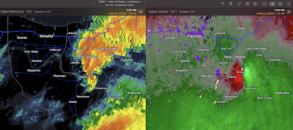
I constantly, especially from people in North Carolina, receive criticism of the Terminal Doppler Weather Radars. This criticism is misplaced as tonight's east New Orleans Tornado demonstrated again.
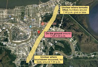
Here is map of the tornado's path across metro New Orleans.
 |
| Matthew Cappucci/MyWeather/CWG |
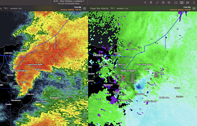
This was the NWS WSR-88D at 7:24pm when the tornado was moving through Arabi and the Lower Ninth Ward. Click to enlarge the images.
Here is the Terminal Doppler Weather Radar at the same time.
The tornado on the -88D, while visible in the velocity data, is not nearly as obvious as it is on the TDWR. It is not just the velocity data (right) but look at the more obvious hook in the reflectivity data. Assuming no attenuation, if I only had one radar to use, and they were equidistant from the tornado, I'd always pick the TDWR.The "Day Before the Day"
 |
| Day Three Outlook for Monday |
 |
| Day Three Outlook for Tuesday |
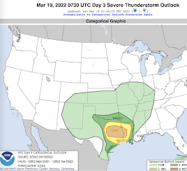
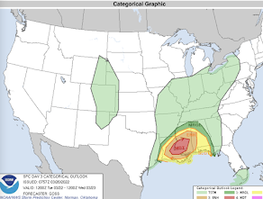
While we don't have the I-35 tornado survey data from yesterday as yet and we don't have any survey data from today, my sense is that yesterday "overperformed" expectations and that today might have underperformed in terms of the number of tornadoes. If this is correct, it may be due to something known as The Day Before the Day.
While I don't know of any research on this topic, rapidly returning moisture combined with the upward vertical motion on the west side of a receding trough will often produce more tornadoes than expected, perhaps because there is more diurnal heating the day before. On "the day," perhaps because the moisture is in place, less heating occurs and it underperforms.
There is nothing profound here, just something for forecasters to keep in mind.



Comments
Post a Comment