Winter Storm Update: 10:25am Tuesday
 |
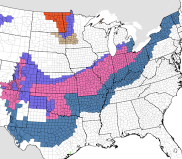
| Updated warning map at 11:15am |
- Orange is a ground blizzard warning for low visibility.
- Pink is a winter storm warning.
- Dark turquoise is a winter storm watch.
- Dark blue is a winter weather advisory (lesser condition).
- Turquoise (NW Montana) is a freezing fog warning.
- Gray is a dense fog warning.
- Gray is a fog warning.
Freezing Rain
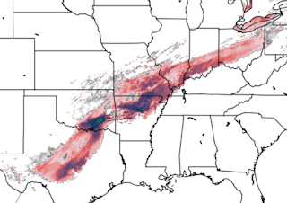
The forecasted area where the greatest freeing rain will accumulate has shifted south a bit since yesterday. All areas that receive freezing rain will experience difficult driving conditions.
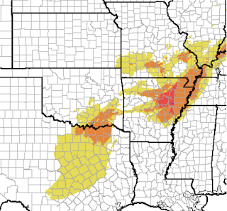
There is a risk of power failures. The Sperry-Piltz power failure index breaks out like this:
- Orange: "Scattered utility interruptions expected, typically lasting 12-24 hours."
- Red (southeast Missouri): "Numerous utility interruptions with some damage to main feeder lines and equipment expected. Tree limb damage is excessive. Outages lasting 1-5 days.
Heavy Snow
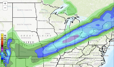
This hasn't changed much since yesterday. St. Louis will have more snow than expected yesterday. 


Comments
Post a Comment