Snow Amount Forecast, 3:55pm
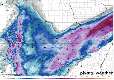
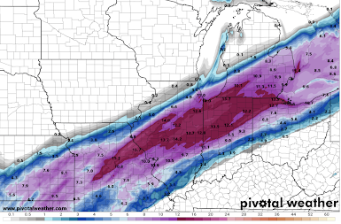
Here my final storm total snow amount forecasts.
Above are the forecast snowfall maps (click to enlarge) to noon Thursday. Snow will continue to fall east of the Mississippi Thursday afternoon and evening with additional accumulations. I will update those amounts late this evening.
Between Chicago and Indianapolis amounts could exceed 14 inches in places.
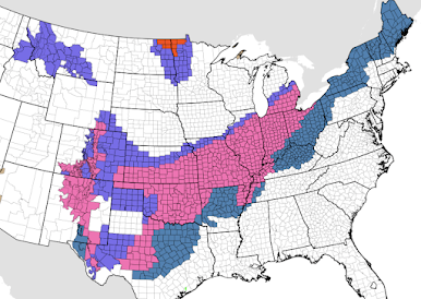
Below is the current NWS watches/warnings, etc.
- Orange = ground blizzard for poor visibility
- Pink = winter storm warning
- Dark turquoise = winter storm watch
- Dark blue = winter weather advisory
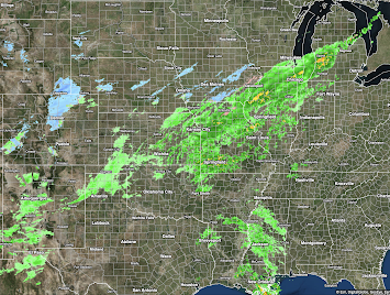
Radar at 3:46pm is below. The rain will be changing to snow this evening in the central U.S.A.


Comments
Post a Comment