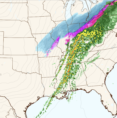
4pm Winter Storm Update
Here are Links to Other Important Weather Information
- The overnight's overnight tornado risk is here. The brown area has a significant tornado risk.
- For a 7-day rainfall amount forecast click here. Rainfalls of more than five inches are likely.
- Latest National Weather Service warnings, etc.
- Scroll down for the "high risk" tornado situation in the South Thursday.
Winter Storm Details
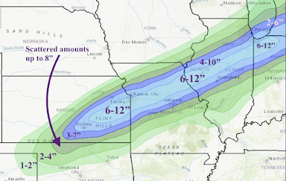
Snowfall With This Storm
Click to enlarge the above map. It is impossible to forecast the exact locations of snow thunderstorms. Those areas that experience a thunderstorm could receive an additional 3 to 4 inches.Blizzard conditions will occur over the eastern half of Kansas, including Wichita and Kansas City, between between 5am and noon Thursday. Travel will be extremely dangerous.


Comments
Post a Comment