An Unwarnable Tornado
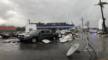 |
| WBKO |
Over the history of this blog, and elsewhere, I have written about obvious tornadoes that were not properly warned and how the trend the last decade has been in the wrong direction. It is something that weather science needs fix on a high priority basis.
Saturday, however, was the type of tornado everyone dreads: the unwarnable tornado. It struck Hopkinsville, KY at about 9:24am New Year's Day. There was no tornado watch and no tornado warning.
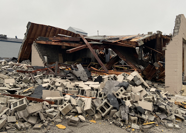 |
| National Weather Service |
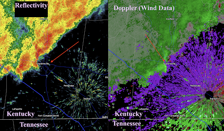
To see why this tornado was unwarnable, let's look at the radar images. This first image, from 9:22am, will orient you to the overall situation. This is two minutes before the tornado struck.
On the left is the reflectivity data, the type you see on television. On the right is the Doppler wind data which meteorologists use to find rotation within thunderstorms. There wasn't any at this point. The red arrow points to Hopkinsville.
Two minutes before the tornado, there is no indication a tornado is about to strike. We can confirm that by zooming in. The 9:22 data shows none of the signatures meteorologists use to detect tornadoes.
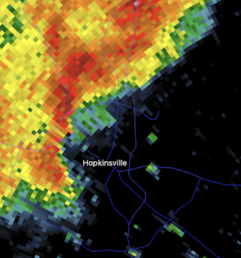
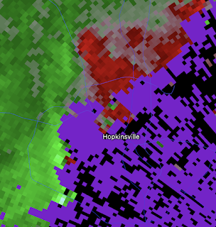
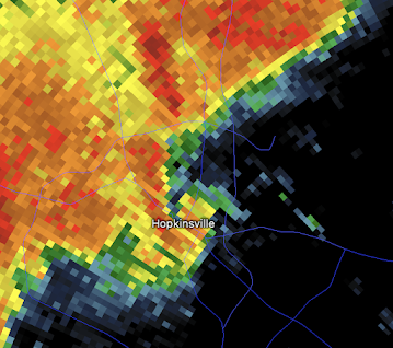
Then, on the very next frame at 9:24, a dreaded "hook echo." It is the classic signature of a tornado right over Hopkinsville.
While noisy, the accompanying Doppler wind data shows that rotation has developed. When red and green (arrows) are directly adjacent to each other, it shows rotation on the tornado scale over the east side of the city.
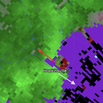
Looking at the next-closest radar at Paducah, KY, there is no sign of a tornado at all.
Usually, we see a hook or a rotation "couplet" form at least a few minutes before a tornado forms. That was not the case yesterday.
This is a case where weather science simply cannot provide an advance warning. The "unwarnable" tornado has become increasing rare as our knowledge and techniques have improved through the decades. And, before anyone brings up global warming, it has nothing to do with our ability to warn of tornadoes. If anything, violent tornadoes have decreased as the atmosphere has warmed.
The bottom line is the people of Hopkinsville had the unfortunate luck to be under a rare unwarnable tornado.
I do wish to reiterate: unwarnable tornadoes are genuinely rare, so please do not lose any sleep over this storm.



Comments
Post a Comment