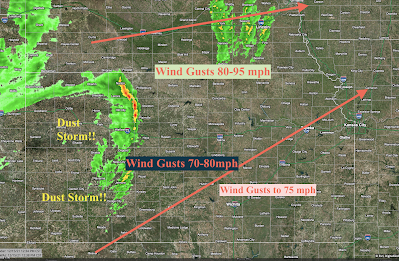
My Forecast From Now to 6pm CST
Please click to enlarge to see wind forecast from now until 6pm. Update: Wichita's Eisenhower National Airport clocked a gust of 64 mph at 1:03pm. The stronger winds are still to the west.
Update II: 84 mph gust in Dodge City at 1:15pm.
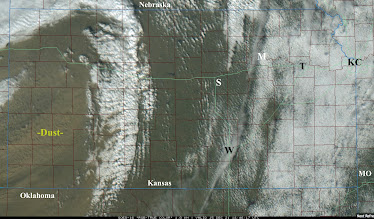
Below is the 12:47p satellite.
The blowing dust can be seen in the textured blown pattern. It will follow the line of showers and thunderstorms -- the latter is the leading edge of the strongest winds.


Comments
Post a Comment