High Risk of Post-Ida Flooding; Especially in Pennsylvania
 |
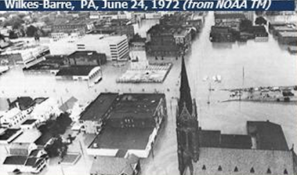
| 1972 Post-Agnes Flooding |
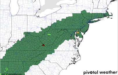
Flash flood watches (below) are in effect all the way from Mississippi to the Atlantic Coast of New England.
 |
| Green = flash flood watch. |
In view of the state's history of terrible post-hurricane flash floods plus the meteorological conditions over the next few days, I am especially worried about Pennsylvania.
Here is the National Weather Service's rainfall forecast for the state, which is sufficient to cause flooding significant flooding.
The Pennsylvania flooding threat is compounded by the fact that parts of the state have received as much as four inches of rain during the last three days (below), meaning a fast run-off of Agne's rain into already high rivers. In Harrisburg, the heavy rain is forecasted to begin Wednesday morning meaning a high degree of danger Wednesday night through Thursday night.
The Pennsylvania flooding after Hurricane Agnes took more than 100 lives and cost about $18 billion in today's dollars.
It is vital that people living in the flash flood watch areas monitor the weather forecasts the next few days. Make you have at least three sources of storm warnings. It wouldn't hurt to prepare a "go kit" of essentials that you can grab and put in the car along with your family if you have to evacuate.


Comments
Post a Comment