Posts

Showing posts from November, 2016

Denting the Southeast Drought

Image
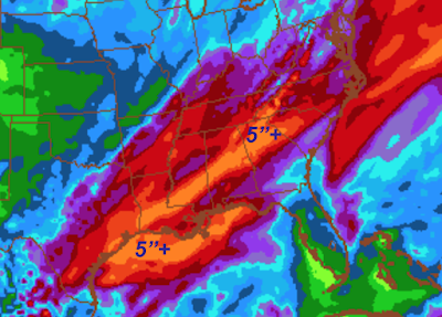
Here is the latest (Nov. 26) drought index for the Southeast. Darker orange = more severe drought. Since then, significant rain has fallen across the region. Additional rains are on the way. Here is the forecast rainfall for the next five days. Assuming the 5-day forecast is correct, then the drought will be significantly improved by the middle of next week.

Questions About the Atlanta Tornado

Image
Yes, there was a tornado in the Atlanta Metro area. Some -- morbidly -- seem disappointed there wasn't more damage. I think this is because there was a consistent debris signature on dual-polarization Doppler radar (see posting below). However, the debris signature -- as explained below -- doesn't tell you much, if anything, about the amount of damage. At AccuWeather Enterprise Solutions , we usually watch the wind circulation on the Federal Aviation Administration's Terminal Doppler Weather Radar which, I believe, has better wind detection capability in these situations. Below is an example from my Twitter feed. The tornado wind signature was tiny and not especially strong. So, I think some may have misinterpreted the size of the debris signature for a more destructive tornado than we hope occurred.

Tornado Has Damaged Parts of West and North Atlanta

Image
We do not have the full details yet, but there has been damage from the tornado (below) in the Atlanta area. You can get locations and times from my Twitter feed:   @usweatherexpert . Here are three images of lofted debris as measured by dual polarization radar. Important note: The fact there is lofted debris does not mean there was major damage. The debris may be tree limbs, etc. Keeping in mind, this is a blog about weather rather than news, I'll turn the coverage over my news colleagues with the AccuWeather news staff and regular news sources. Via Twitter (below) very rough idea of the approximate track of the ATL tornado. Do not yet know whether is was intermittently on the ground yet, etc.

Tornado Situation Just West of Atlanta

Image
Radar from 1:12pm EST. Unfortunately, at that time, the location of the possible (rain-wrapped and very difficult to see) tornado does not line up well with the tornado warning (red polygon). This is the type of situation where tornadoes can form very quickly and be difficult to warn of. Regardless, please keep up on the latest weather if you are in the tornado watch (area below), including the Atlanta Metro Area.

Tornado Watch Through Late Afternoon

Image

Third Day With a Tornado Threat

Image
The area in brown has a significant threat of a tornado or two which does include the Atlanta area. I will try to update on the threat this afternoon.

What Happens WHEN (not if) the Major Earthquake Hits Southern California

Sobering details here .

Tornado Outbreak Update: 9pm

Image
Overnight tornado watch just issued until 5am CDT. Tornadoes overnight are exceptionally dangerous: Death rates at least 4 times higher than during the day. Make sure you have an tone alert weather radio or similar warning reception system. Red polygons are tornado warnings as of 8:55pm. This is so important, I wanted to make sure my readers know of the overnight threat. This truly is the last update of the night. Good luck and stay safe. 

Tornado Outbreak Update: 7:10pm

Image
Fourth tornado watch issued ... this one for northern Alabama to the north of Birmingham and for Tennessee south of Nashville. It includes Huntsville. Watch is in effect until midnight. Please note that strong storms continue southwest into Louisiana. If you scroll down, you'll see all four tornado watches which all remain in effect. There is some possibility the tornado threat will continue overnight. It is possible additional watches will be issued. However, it has been a long day and this is the last blog update on these storms. However, I may continue to post on Twitter @usweatherexpert .  Please keep up on the weather and have a safe night. ADDITION: 7:12pm. The overnight tornado forecast from SPC continues to be rather ominous. If you live in the hatched area, it is essential that you keep up on local weather warnings!

Tornado Outbreak Update: 5:40pm CST

Image
The tornado outbreak continues over the region. There are 6 tornado warnings (red polygons) currently in effect. There have been confirmed tornadoes with damage!  With darkness over the region, it is especially important to keep up on local sources of weather information. Here is the radar at 5:39pm CDT. A third tornado watch has been issued...it is for western Alabama until 10pm. Scroll down to see the other two tornado watches currently in effect. The AccuWeather app will provide notifications of countywide tornado warnings. Pair it with a weather radio and you have two immediate sources of tornado, flash flood, and severe thunderstorm warnings. Note: We no longer live-blog storms. I do, occasionally, put short-term tornado information into my Twitter feed:   @usweatherexpert  so follow me there.

Second Tornado Watch Issued - Many Warnings in Effect

Image
This tornado watch is in effect until 11pm CST. Note, again, a "high risk" of tornadoes and a moderate risk of strong tornadoes. There are multiple tornado warnings (red polygons) as of 4pm as well as severe thunderstorm warnings (yellow polygons) now in effect. If you live in either of the tornado watch areas (please see below) it is important to keep up on the weather at the first sign of the approach of a thunderstorm.  Reminder: we no longer "live blog" storms. Please keep up on the latest local weather information. I will update this blog at least one more time this evening.

First Tornado Watch Issued - Tornado Threat Well Into the Night

Image
The first tornado watch has been issued and is in effect until 9pm CST. Note that the risk of tornadoes is "high" and that risk of strong (≥F-2) tornadoes is "moderate." Here is the latest tornado outlook valid from now until 6am CST Wednesday. There is a real risk of the tornado threat continuing after 9pm and additional watches may be needed. Everyone within the brown area is at significant tornado risk. The hatched area is where violent tornadoes are forecast to occur. The yellow, and especially, orange areas are at special risk. The first tornado warning (red polygon) south southwest of Monroe, LA was just issued. Storm moving northeast. Radar from 2:02pm CST. Please pay attention to the weather if you live in these regions and thunderstorms approach or the sky appears threatening. 

Tuesday's -- Serious -- Tornado Risk

Image
The NWS Storm Prediction Center is now forecasting violent tornadoes later today and tonight. Five percent (brown) is the significant threshold of a tornado threat. Ten percent (yellow) is, of course, double. The hatching means violent tornadoes are possible. So, if you live in these areas, please keep up on the latest weather information for your area(s) of interest! I will update later today.

Update on Today's Tornado Risk

Image
This product, from the NWS Storm Prediction Center, depicts (in this case) their forecast of an enhanced tornado risk in the orange area. Tornado watches are out. Remember: We no long live-blog tornado situations. Check your local sources of information for updates. Remember: I recommend at least two sources for tornado and other critical weather warnings.

Cyber Monday!

Image
Copies of Warnings  are available online from both Amazon and Barnes & Noble . Both give Warnings  5-Star Ratings:

Tornado Risk Today and Tonight

Image
The 5% (brown) area is where there is a signifiant risk of tornadoes today (perhaps starting fairly soon) into tonight.  The yellow and red areas are where there is a significant risk of damaging thunderstorm winds.  Please keep up on the weather if/when a thunderstorm approaches in your area!!

Another Hurricane Season...

Image
...without a major hurricane (Cat. 3 or more) making landfall in the United States. The tall line blue light at right is the record number of days at more than eleven years. It dwarfs all of the other record intervals. Remember, back in 2005, after Katrina, when global warming was going to cause an increase in number and intensity? Another climate 'science' failure. Remember, back in 2011, tornadoes were increasing in number and intensity due to global warming? The last two years have been record low  numbers of tornadoes. The low numbers are now, you guessed it, attributed to global warming . We need to remember: Our good luck is not going to last forever!

Possible Tornado Risk Monday

Image
If you live in the yellow or red areas, play attention to the weather tomorrow. There is the possibility of thunderstorms with damaging winds and, possibly, tornadoes.

Sunday Fun: World's Tallest Basketball Shot

Image

Travel Weather Tomorrow

Image
There is a blizzard warning out in southern Wyoming (orange) with a high wind warning in southeast Wyoming (brown). Pink is a winter storm warning. Here is the weather in the Great Plains.

Small Business Saturday!

Image
If you would like a personally autographed copy of Warnings  send $25 to: Mike Smith Enterprises, LLC, 4031 N. Tara Circle, Wichita, Kansas 67226. Don't forget the inscription you would like.

If We Aren't Careful The California Drought Will End 997 Years Early

Image
The drought is already over in far northern California. Periodic rains are occurring over the rest of the state. Looks like the thousand year drought caused by global warming is going to end a bit early.

And, Now For Some Good News

Humanity only has ten years left due to a " mass extinction ." So, I guess global warming doesn't matter.

A Dent to the Southeast Drought?

Image
The United States' GFS model is forecasting more than 5 inches of rain over the parched Southeast. Let's hope it is correct.

Fatal "Thunderstorm Asthma"

I had never heard of thunderstorm asthma before.

If You Want Something to Get Your Mind Off Black Friday

Take a look at this brief, and well thought-out, essay on President-Elect Trump's perspective on climate change policy .

Something Different: Superb Career Advice

From my highly successful friend, Dr. Roger Pielke, Jr.    The author is Robert Sternberg. 

AccuWeather is Proud to Have Them Among Our Clients

Image
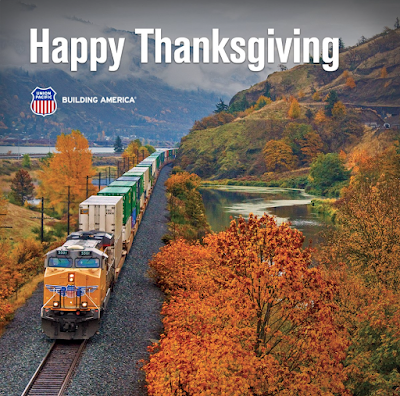
A gorgeous tribute to a special day. 

And, a Special Happy Thanksgiving

...to those that have to work today! I was just reading on Facebook that one of our meteorologists, who had to work today, was having turnkey and dressing at 5am. That's the spirit!!

HAPPY THANKSGIVING

Lots of people, because of travel, will not read this blog the next few days, so, HAPPY AND SAFE THANKSGIVING from Mindy, Forecaster Evie, Assistant Forecaster Jillian and me.

The Improving Water Situation in California

Image
Here is the current drought/moisture situation across the United States. Note the generous moisture over the Northwest and adequate moisture in Northern California. The drought still continues in Southern California. Extreme drought continues in the Southeast. More rain is on the way for that region. Here is the 7-day rainfall forecast. The northwest portion of the severe drought area will see some relief. The "too much of a good thing" rainfall may become a reality in Washington and Oregon. From about 7 to 10 days into the future, central California may see some significant rain while eastern part of the drought region in the Southeast may also see some relief.

As You Consider Gifts for the Holidays

Image
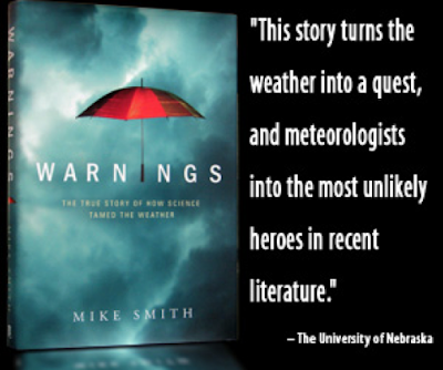
There are few gripping books that capture of wonder of science and how it benefits humanity  as well as "Warnings." "Just a handful of books in the last generation have been able to capture the importance of science and its benefit to mankind in an engaging manner:  Isaac’s Storm, Rocket Boys, The Right Stuff,  and the  Joy of Chemistry.  Add to this list,  Warnings: The True Story of How Science Tamed the Weather." Warnings  is the upbeat and uplifting story of how weather science keeps planes from crashing and saves lives in hurricanes and tornadoes. You can purchase from Amazon,   here .  If you prefer to shop with Barnes & Noble, go here .  Or, ask for it at your local bookseller.

A Couple of Thoughts Concerning Yesterday's Tsunami in Japan

Image
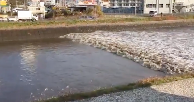
After all that Japan has gone through, never have I been so glad to see a tsunami that looked like the one below: Via YouTube I imagine that tsunami-forecasting oceanographers yesterday had the same feeling of relief that meteorologists have when we issue a tornado watch and a tornado warning and there is nothing but a single weak tornado in the middle of nowhere -- but, that tornado is photographed by 30 storm chasers, thus validating the scientific accuracy of the forecast . Congratulations, tsunami forecasters. So glad the waves were weak.

If You Are Traveling Today

Image
Below we covered the tornado threat later today. Here is the travel map for the rest of the nation. And, below, is the snow amount forecast. Check with AccuWeather through the day for current radar and other updates.

Tornado Threat in the South

Image
There is a tornado threat in the South today. The brown, 5%, area is where you should be concerned. Please monitor the weather if thunderstorms approach.

Black Friday Book

Image
Beat the crowds! Here is a great book to give as a Christmas gift: At Amazon . 

Video of Today's Japanese Tsunami

Image
Thank goodness, thank goodness it wasn't a significant tsunami. I was amused by some on Twitter this afternoon who apparently did not know the metric system who were freaking out about the wave being 60 cm in height. (60 cm = 2 ft.).

Preliminary Thanksgiving Travel Weather

Image
From AccuWeather , here are some preliminary looks at the weather for... Tuesday Wednesday

Sunday Fun: "The Bubble"

Image
From Saturday Night Live,  a great skit last night:

Sunday Great News: Oil!

One of the largest oil finds in the history of the world!  Details here .

The Results of the Blizzard

Image

Be Careful Around Train Tracks!

Image
Via Twitter: If a train can do this to a big rig, think what it can do to you! The fad of using railroad tracks for prom photos, engagement photos and graduation photos is very, very dangerous.

My Talk Over Lunch Today

Reminder of my talk at lunch today:  I will be talking about the latest advances (and, they are considerable) in weather forecasting and storm warnings! Pachyderm Club of Wichita Ruffin Building, 9th Floor (Petroleum Club) Broadway and Douglas Downtown Wichita The Petroleum Club serves a wonderful buffet lunch for, I believe, $12 (biggest bargain around). I recommend arriving at 11:40.  See you then!!

Update on Fire Weather Danger

Image
NWS SPC There are two areas of the nation with very high very wildfire danger levels. Please act accordingly and be extremely careful outdoors.