Posts

Showing posts from January, 2015

Winter Storm Update: 7:15pm

Image
Here is the current AccuWeather Regional Radar: Forecast radar for 8am Sunday. After 9am, snowfall rates should rapidly increase in the Midwest with road conditions between Chicago and Cleveland on Interstate 80 deteriorating very rapidly due to heavy falling snow, poor visibility and increasing winds. This conditions will also exist through northern Indiana (I-64 north of Lafayette will have poor conditions, also). Last update of the evening. 

Status of the Storm at 5:40pm

Image
Here is the developing storm as shown by AccuWeather Regional Radar at 5:37pm. It is just getting warmed up.

Forecast Snow Amounts

Image
Forecast snowfall now to 4pm Sunday Our model shows heavy snow in a large area during the next 24 hours. You might wonder why it is forecasting less snow from south of the Quad Cities to east of Peoria and then down toward Quincy. The reason is the model believes there will be some mixed sleet. When this occurs, snowfalls rapidly decreases. If the sleet does not occur amounts will be around 9 to 10". Keep in mind that snow accumulation forecasts are generally accurate to within ±25 miles.  I'm switching to a second depiction farther east. The area in orange calls for high travel danger due to wind gusts to 25 mph and very heavy rates of snow tomorrow and tomorrow evening. There is a real chance of getting stuck.  Graphic Courtesy of Dr. Ryan Maue Finally, the region from the Pennsylvania Turnpike toward NYC and Long Island may have light freezing rain. This probably will not be enough to cause power failures but may cause very hazardous driving conditions. P

Storm Timing

Image
Because so many people are making plans, let me give you an outline of the timing of this storm. 10pm CST Saturday 10am Sunday 6pm Sunday 7am Monday 1pm Monday I'll have snow amount forecast later this afternoon.

Another NYC Forecast Mess

Image
I am working on an updated forecast pertaining to the snow storm now developing over the Plains and forecast to move to the Northeast (scroll down to see earlier forecast). However, take a look at this forecast (12Z NAM + Kuchera for meteorologists) for snow amounts in the borough of Manhattan: Now, we know these forecast amounts are accurate to roughly 25-30 miles, which was true in the blizzard earlier this week. We have the potential for another wide variation situation in the NYC area. That said, I'll get back to working on the forecast.

AccuWeather Has Been Busy

I am very happy to announce that AccuWeather has acquired WeatherBank and Hazardous Notifications, LLC in the past two weeks. WeatherBank is a leader in the field of weather-driving analytics; using weather information and forecasts to make better, and more profitable, business decisions. This is a rapidly growing field as businesses learn that analytics is an essential tool for managing their businesses. Hazardous Notifications has created amazing computer models (yes, they did very well with the blizzard earlier this week) used for precision forecasting of tornadoes, blizzards and extreme weather. We are already working on new products for our clients that take advantage of these capabilities. Unfortunately, with the snow storm pending in the Midwest and Northeast, I don't have time to write more but will when I have a chance. If you are not doing business with AccuWeather, you should be.

Yes, It Rains in Southern California

Image
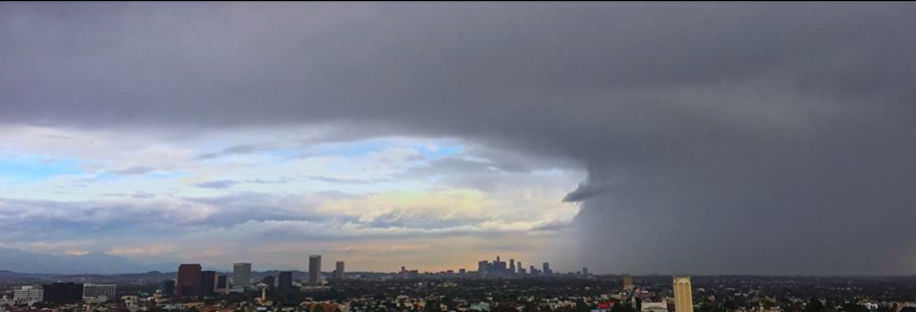
Via Facebook and Kevin Kloesel Just not often enough in recent years.

Another Winter Storm

Image
Oh, joy. It is another winter storm. AccuWeather has storm start times and more information.

"Alternative" Energy: High Cost, Poor Results

In Europe : Europe could have saved itself $100 billion by installing solar power panels in sunnier countries and wind turbines in windier places, the World Economic Forum's "Future of Electricity" platform said in a report released on Tuesday. The report, written with consultancy Bain, added that another $40 billion could have been saved by better cross-border coordination and bigger power cables between countries. In the United States : An ambitious and controversial push to erect America's first offshore wind farm has been dealt what some call a potentially "fatal" blow after two utility companies pulled out of commitments to buy energy from the lagging operation.  The $2.6 billion Cape Wind project, a private operation benefiting from millions in federal subsidies, is attempting to pioneer offshore wind energy in pursuit of an eco-friendly, sustainable energy supply. Wind turbines would be installed off the coast of Massachusetts' Cape Cod

Happy Kansas Day!!

Image
Photo of Last Night's Wichita Sunset by Martin Ufford via Facebook Today is "Kansas Day" -- the 154th anniversary of our state's admittance into the union. In addition to the terrific people and wonderful, inexpensive lifestyle, it is a meteorologist's paradise. Happy Birthday, Kansas!

Gorgeous Photo of Post-Blizzard Snow

Image
From NASA and NOAA: And, if you are counting, here are the final snow accumulations:

Ending the Day With a Smile

Image
With more snow in the forecast for many areas east of the Rockies, let's end the day with a smile! SHINE 95.1

AccuWeather In the Storm

Image
Today is a gorgeous day in Kansas with temperatures expected to be in the 70's this afternoon, not dissimilar to when I took this photo last spring. As everyone knows, it has been an entirely different story in the Northeast. Before the Blizzard of 2015, AccuWeather began reaching out to its railroad and other clients with special messages on Saturday that preparations needed to be made for a major storm. One of those is Norfolk Southern Railroad (at right, BNSF Railway at left). AccuWeather serves 100% of the United States' class one railroads and most of the rest. When we flash the warning that a blizzard is on the way, fuel supplies for "switch heaters" (below) are checked and the heaters readied, snow plows are moved by rail into the affected region and schedules are modified. We often have conference calls with our clients during the storm. Railpictures.net AccuWeather invented  the "track-specific" storm warnings where precision information,

FYI...

Light blogging today. I have other work I must  catch up on plus I'm exhausted. More later...

While on the Subject of Weather Communications

A very informative editorial here .

Want to Learn How Meteorologists Do What We Do?

Image
Philadelphia meteorologist Kate Bilo is commenting that the amount of progress made in storm warnings of all types is "staggering." Warnings: The True Story of How Science Tamed the Weather  tells how horrific storms used to kill thousands and how weather science, today, saves the vast majority of those lives. It is written in the form of a novel, not as a science book and has received outstanding reviews by both the critics and reading public. And, yes, I even talk about forecasts that were truly busts and what it is like to be in a meteorologist's shoes when those occur.

Are Probabilities the Answer?

Image
Once everyone started to calm down this morning, many of my colleagues started proclaiming forecast probabilities are the answer to the Manhattan 'bust.' For the time being, I mildly disagree. The concept is fine, especially for specialized users. The issue is the implementation. The snow amounts across the NYC Metro area ranged from 7 to 28 inches. So, let's consider my friend and NYC meteorologist Janice Huff. Keep in mind that objective research demonstrates, over and over, that television is the #1 source of information in critical situations. Imagine her weathercast last night under the proposed probability technique: The probability of 2" of snow at Newark is 80%. The probability of 8 inches is 60%. The probability of 15 inches is 40%. The probability of 20 inches is 20%. The probability of 2" of snow in mid-town Manhattan is 90%. The probability of 8 inches is 70%. The probability of 15 inches is 50%. The probability of 20 inches is 30%. The

Kansas' Resort Weather

Image
KWCH TV Graphic Come and see us!!

A Meteorologist's Thoughts on The Blizzard

Image
I have been a paid forecaster since I was 19-years old (WKY TV, OKC). I turned 63 earlier this month. While I will not claim that 45-years of being a practicing meteorologist has given me any special wisdom, it has certainly given me lots of experience. So, I want to share some thoughts with you. When I awakened this morning and began looking at the storm and the meteorology discussion boards (for snowfall amounts) I was shocked by the amount of self-flagellation going on with regard to the NYC forecast. Over and over, meteorologists were criticizing themselves and their colleagues for getting the Manhattan (only one of the five NYC boroughs) wrong.  Let’s hold it a minute! While our forecasts were far from perfect, two facts stand out, at least to me: ·        The reports from Manhattan that I have seen indicate 8-9 inches accumulated. ·        Far east Queens had 15+inches (still snowing) and Islip, last I saw, had 23” with moderate snow still falling.

Blizzard of 2015 Update

Image
Current Conditions in Boston Worcester, Mass. Lyme, CT Here are some current snow amounts, with snow continuing to fall: Worcester, MA - 25" Islip, NY - 20.9" Killingly, CT - 20" Falmouth, MA - 19" Dracut, MA - 18.1" Plymouth, MA - 15.8" Lowell, MA - 23" More than two feet fell on Long Island with severe drifting. The official snow amount at Islip was 21" Snow drifts in Tewksbury, MA Providence  Here is the latest AccuWeather Regional Radar: The heaviest snow in NYC was in the eastern part of the boroughs and on Long Island.

9:45pm Blizzard Update

Image
This is what the blizzard looked like on Long Island at 9:35pm. Winds there are gusting to 45 mph. Here is the Long Island radar which snows the snow moving west northwest. NWS dual-polarization radar confirms the bright yellow is snow at a rate of about 4" per hour. There may be some lightning with it. Still not changing the snow amount forecast. Winds will increase and snow will increase from the Hudson Valley through southeast New England during the night. Last update for the night.

Year: 2000. Genuine Climate Scientists™ Told Us...

"…snowfalls are a thing of the past."  See the article for yourself, here .

Big Climate: The Climate Ghouls

Image
Yesterday, on Facebook, I posted an item asking how long it would take until the climate cult started blaming the Blizzard of 2015 on global warming. Answer? Nineteen hours. We'll get to the science in a moment. But, this whole exercise strikes me as ghoulish. Big Climate can't wait until a huge storm -- that will seriously inconvenience or even kill many people -- to pounce with its propaganda, regardless of whether the science supports their claims.  First, the peer-reviewed science does not  support these claims. Check here and here , if you wish to read it. There is no upward trend in Northeast blizzards.  Second, just check the climate history of New York City: 1888: 1893: 1947: So, the scientific literature does not support a claim that blizzards are worse or more frequent. And, if severe blizzards occurred before CO2 levels began to rise (late 1950's) how in the world is the current blizzard caused by global warming??!!

Forecaster Evie: Are You Kidding??

Image
Forecaster Evie and I just saw a television reporter in the Midwest stating, "I'll see you in NYC tomorrow." Evie and I say, "Wanna bet?" There is 5" of snow on the ground in New York City already. Kennedy Airport has reported wind gusts to 37 mph and the winds are just getting started. The satellite (below) shows the low pressure system slightly  west  (bad!) of where it was predicted to be at this point. Under those clouds are thunderstorms -- more bad news. The AccuWeather map below shows cloud-to-ground lighting flashes. Those flashes indicate a strengthening weather system. Here is the AccuWeather Regional Radar showing the storm as of 6:15pm As the storm strengthens the movement of the snow is becoming more westerly than on the last update. It would not surprise me to see a spot or two on Long Island or southeast New England have between 35 and 40" whipped by blizzard winds. Drifts may exceed 8 ft. in those areas. Otherwise, the

Blizzard of 2015: Forecast Maximum Gusts

Image
These are the forecast maximum gusts. Very impressive. Power crews are already heading in the direction of the Northeast to restore power. Please be prepared for power failures if you live in one of the high wind areas.

Blizzard Update: 5:25pm EST

Image
The National Weather Service says "New York City will be a raging blizzard by 6am." Here is the AccuWeather Regional Radar at 5:15pm EST: I have placed arrows depicting the direction of movement of the snow. Yes, that is rain out over the Atlantic but with the cold temperatures inland the precipitation will stay in the form of snow over land. In New York, winds are now picking up with about 4 to 5" already on the ground. New York will see about 24" with another few inches on Long Island. Subways will be shut down at 11pm. My snow amount forecast is unchanged; it is pretty much what I was forecasting yesterday with the exception of the heavier amounts around Boston. At Logan, I'm thinking about 28-30" however, there will be so much drifting it will be hard to tell. Winds will be increasing across all of coastal New England overnight. Blizzard conditions will spread across the areas tinted in green and in coastal Maine. So, the blizzard has arrive

3:35pm Blizzard Update

Image
Via Twitter, photo of Times Square from 3:30pm. People walking down Broadway and you can see a TV camera set up. Heavy snow falling. ORIGINAL POSTING Heavy snow now falling on New York City. Photo below, minutes old, of Central Park. Newark has 4"on the ground. LaGuardia and JFK have 2", each. Here is the AccuWeather Regional Radar at 3:30pm EST. Hunker down. Here we go.