Posts

Showing posts from January, 2014

Update on Tonight's Midwest Storm

Image
Here are the National Weather Service's travel advisory (blue) and winter storm warning (pink). In Oklahoma, southern Kansas and southeast Missouri the advisory is for freezing drizzle and some slick spots. The winter storm warning is for heavy snow. In Chicago, 6 to 12" are forecast. As previously mentioned, there is a second storm behind this one.

With All the Snow Forecast the Next Few Days...

Image
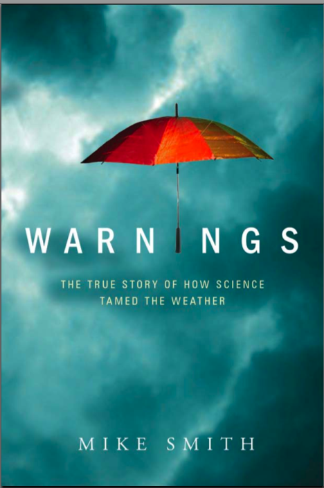
…you might want to read a good book about weather. Here is the first chapter of mine . Once you click the link, click "Kindle Edition" under the book cover at upper left. If you like what you read, you can order the ebook from Amazon at the link or for the Nook here . Warnings  has a 5-star rating from both Amazon and Barnes & Noble. Hunker down with a hot chocolate, a good book, and watch the snow out the window.

Winter Storm Early Next Week?

Image
While the exact locations and amounts are not forecastable at this point, I wanted to give readers a "heads up" about a likely winter storm the first of next week. Here is a general guide. You plan your week accordingly. If you are planning to travel by air, check here for tips.

Midwest Winter Weather Update, 8:50am

Image
The blue is a travel advisory for snow except in southern Kansas and southwest Missouri where it is for freezing drizzle. The dark green from central Illinois to Michigan is a winter storm watch for heavy snow.

Why the Current Drought Isn't Caused by "Global Warming"

Image
Today's headline: Las Vegas – January 30, 2014  – Four leading climate change researchers from states experiencing emergency-level drought argued that the drought is clearly linked to climate change, with its current effects and future outlook made worse by persistent higher temperatures due to a warming climate. -- one of a number of stories today about the drought in the West. There has been a lot of nonsense lately about how "the drought in the West" is being "caused" by global warming/climate change/global weirding, etc. At this point, there is no reason to bring global warming into the discussion. #1. There is usually a drought in the central or western U.S. in the odd-numbers decades. I've researched this back into the 1880's. Here are are examples of the Palmer Drought Index. Look at the dates. See a pattern? In fact, if you ask a Kansan over about the age of 40 they will tell you about the "twenty-year drought cycle....

Plains and Midwest Storm

Image
UPDATE: 5:47pm CST. Here is a probability map of 0.01 inches of freezing drizzle accumulating during the calendar day (midnight to midnight) Friday. Disregard the little minima east of Wichita.  I suggest that those in the blue-orange-red areas plan to allow extra time driving.  ORIGINAL POSTING: A winter storm of moderate intensity will bring snow to a stripe from the Rockies to the Midwest. Winter storm warnings are in effect along I-76 in Colorado and Nebraska and along I-25 in Colorado. There is also a winter storm warning for I-80 in southeast Wyoming. A winter storm watch has been issued for Chicago as this storm moves east. Spotty freezing drizzle may cause patchy slick roads in a large area later tonight and Friday. There is another, likely stronger, winter storm behind this one. We'll likely start coverage on the blog tomorrow. 

Finally, the Governor Acknowledges He Had the Warning

Image
Better late than never, I suppose. Georgia Governor Nathan Deal acknowledges there was an advance warning and that he did not act upon it. Meanwhile, a different Georgia official yesterday said (paraphrasing) the gridlock (as opposed to the weather) could not have been anticipated. Please allow me to quote from AccuWeather Enterprise Solutions' Storm Potential Notice issued to Atlanta-area clients 21-hours before the snow began accumulating. It was reiterated at 7am Tuesday, the morning of the snow: The ice and snow amounts indicated here, spread over a large area generally unaccustomed to seeing winter storms of this magnitude, will bring transport and logistical operations to a virtual standstill. Delays and cancellations will cripple air, ground, and rail travel for days.  I don't know how much clearer anyone could have been. Speaking for myself, I appreciate Gov. Deal finally acknowledging a warning was in place but I wish Georgia officials would stop rationaliz...

Two Storms Today

Image
Here is the latest AccuWeather Regional Radar: There is a winter storm warning (pink) for the Twin Cities and there are one hour flight delays. In addition, there is a second storm forming in the Rockies. The rose color is a wildfire weather conditions warning and the brown is a high wind warning.  This storm is forecast to move out into the Plains, especially near the Kansas-Nebraska border. 

Mark My Words

There will be a "population boom" in the Southeast in nine months.

Happy Kansas Day!!

Image
Let's lighten the mood a bit with the late Pete Seeger singing the State Song of Kansas, Home on the Range.  Today is Kansas Day, We were admitted to the Union on January 29, 1861.

Al Roker Gets it 100% Right

Image
Friend and Raleigh meteorologist Nate Johnson gets it exactly right when he says, While I appreciate the need for humility when we blow a forecast - and trust me, no one takes it harder than we do when we get a forecast or communication wrong - I think we need to be more forthright when we get them right. If folks want a pound of flesh for every busted forecast, I'd like the courtesy of not being thrown under the bus when the forecast was good. The Governor of Georgia last night blamed meteorologists. The whole reason I wrote Warnings: The True Story of How Science Tamed the Weather  was because former New Orleans Mayor Ray Nagin blamed meteorologists for his incompetence during Katrina. I spoke, at length, this morning with a reporter from the Atlanta Journal-Constitution  and she told me about a friend of hers still trapped after 19 hours with a baby she is breastfeeding in the car! While meteorology is far from perfect, there are real consequences for not act...

This Book Should Be Required Reading for EVERY Public Official

Image
Via Twitter, 12:40am Wednesday in Atlanta and it is still gridlock. I debated whether to write post praising my own book. Decided not to. Then, late Tuesday evening, I started reading about the blame meteorologists, of all people, are getting for the public works and school fiasco in Georgia. That changed my mind. FACT: A winter storm warning  was issued between 3 and 4am Tuesday for the Atlanta Metro area. Schools should have been called off. Instead, they decided to have school. People have been (as of this writing) trapped in their cars for 10-12 hours. There are still school buses, full of children, trapped. People may die. Atlanta, 12:30am Wednesday. Utter gridlock. As we have discussed on this blog over and over, the progress in storm warning quality in the last five to ten years is remarkable. Even I have been surprised at the rate of progress. The problem is, people remember a busted forecast from 20 years ago and think nothing has changed. They often do not act ...

Last Update on Southern Storm

Image
Here is the AccuWeather Regional Radar at 10:40pm EST. We are now out of "forecasting" mode and into "reporting" mode. So, this will be the last update on the storm.

The Pattern Change

Image
How long has it been since we have seen winter storm warnings (pink) this far west? Quite a while. The weather pattern is changing. Stay tuned for more information!

Southern Storm Update, 7:10pm EST

Image
Here is a photo via Twitter from @Stephen_Nix. This photo was taken on I-280 in Birmingham. Here is the AccuWeather Regional Radar at 7pm: Unused to driving on snow and ice? Click here . Have a flight to/from the region booked?  Click here . And, if you'd like to upload a great 60 page ebook (full color photos) about tornadoes, click here . It will be a great way to pass the time while you are snowed in.

Southern Storm Update, 5:05pm EST

Image
My friends at WRAL TV have posted this forecast for North Carolina. They are excellent forecasters. In my opinion, power failures are likely in the icing area. Here is how to prepare for an ice storm .

Southern Winter Storm Update, 3:11pm CST

Image
Here is the AccuWeather Regional Radar: This is a historic storm for its size. New Orleans, Birmingham, Atlanta and just about every city is crippled. The Birmingham airport is actually closed. More than 3,000 flights have been cancelled. Please scroll down for ice storm and driving information. ADDITION: From Matthew Sitkowsky (@MattSitkowski) via Twitter. The progression of traffic conditions in Atlanta (times Eastern). ADDITION II:  From @SuzieQ on Twitter. Arrows point to abandoned cars in Birmingham. You can see people walking in middle of streets. Friend and famed meteorologist James Spann had to abandon his car and walk to the TV station.  Sleet is now accumulating at the National Weather Service office in Mobile.  ADDITION III:   States of Emergency have been declared in Louisiana, Mississippi, Alabama, South Carolina and North Carolina 5:12pm EST, Georgia added. ADDITION IV:  " Atlanta-area schools have suspended bus service...

Southern Winter Storm Update, 1:35pm CST

Image
Sperry-Piltz Ice Accumulation Index The red areas are where "numerous" power failures are expected. If you look closely you'll see a couple of isolated purple areas. Here is how to translate: Here is the checklist for preparing for an ice storm .

Southern Winter Storm Update, 12:40pm CST

Image
The peach color over central Alabama is a "Civil Emergency Message." Traffic across the area is, according to numerous reports, completely snarled. And, from Facebook and Twitter, I understand Birmingham and Atlanta schools went ahead and held classes today. They are instructing people not to drive so first responders could get around. Birmingham has receive a mix of ice and snow. Atlanta is getting a snow. Jim Cantore just tweeted, "this is bad" meaning the situation of trying to get Atlanta school kids home. In the pink "winter storm warning areas" please take this storm seriously and stay off the road unless it is a genuine emergency!

Southern Storm Update, Noon CST

Image
Update: 12:10pm: "all emergency personnel in Birmingham are stretched beyond the limit." They are asking people if they are safe and someplace warm not  to travel until traffic is unsnarled. Here is AccuWeather's snow forecast: The AccuWeather Regional Radar at 11:49 am shows the precipitation are has grown considerably since the last update.

Southern Storm Update, 8:15am CST

Image
The southern storm is now in progress. Below is AccuWeather Regional Radar as of 7:54am CST. Here is AccuWeather's forecast map for this storm: If you are dealing with a cancelled flight or considering driving into this, please click here . Southeast Georgia, including Savannah, should prepare for an ice storm. Checklist here .

Southern Storm Update, 10:20pm

Image
Here is the forecast for 7pm EST Tuesday. Rose is freezing rain. Orange is sleet. Blue is snow and green is rain. While this type of forecast likely will not be perfect, if you are in or near the rose-colored area, please be prepared for power failures.

The Beginning of the Southern Storm

Image
AccuWeather Regional Radar at 8:15pm CST.

Catastrophic Global Warming: The Hammering Sound You Hear...

Image
…is the nails going into the coffin. A bit of background. Russia and China never really bought into the catastrophic global warming hypothesis (CAGW). The European Union and the British Commonwealth nations went for it hard. The U.S. tilted in that direction but never ratified the Kyoto Treaty and never imposed a carbon tax as Al Gore wanted. Now, after embracing alternative energy, Europe wants out : Der Spiegel , hardly a conservative outlet, goes on to report, But now it seems that the climate is no longer of much importance to the European Commission, the EU's executive branch, either. Commission sources have long been hinting that the body intends to move away from ambitious climate protection goals. And, now from Australia, where they embraced a carbon tax and other measures, the former Chief Scientist of Australia's Division of Atmospheric Research writes [bold emphasis his, green link is to data posted on my blog that support his contention about no warming],...

Southern Storm Update

Image
Here are the probabilities of 0.25 inches or more. That is generally the threshold where power failures occur. How do you prepare for an ice storm? Click here . A summary of the NWS warnings: The deep purple around Savannah is the official ice storm warning. The pinks are winter storm warnings for ice or snow (check your local AccuWeather forecast). Keep in mind that this far south the normal accutrements for dealing with winter storms are non-existent. There are no snow plows, salt trucks or (at airports) deicing trucks. Since the storm has not yet begun, here are airline travel tips .

There is Twitter Content that is Not on the Blog

Image
Especially as we move toward storm season, please follow me @usweatherexpert.

Cold Front and Large Fire

Image
While I can't be certain the cold front helped set it off, a big fire developed in Butler Co., Kansas, along and behind the cold front and you can see it on the Wichita NWS radar. At 8:01, as the front is passing through, there is no apparent fire. Behind the front, with winds gusting to around 50 mph, the smoke plume can be seen but it is not well-defined. The smoke plume is very well-defined at this point, minutes ago. The fire is south southeast of Augusta, Kansas. If I get any news as to what is burning, I will post it. Update: It was a grassfire a mile long by a half-mile wide. 

Northern Winter Storm Update

Image
The blizzard warning has been extended closer to Chicago (orange). Visibility in the city is as low as 4,000 ft. with light to moderate snow falling. The heavier snow is moving out at this time. The governor has called out the National Guard in Minnesota to assist with the extreme blizzard conditions in the southern part of the State. High wind warnings continue in brown. The high wind warnings in Kansas are just along and behind the front where winds are gusting to 50 to 55 mph. Three thousand Westar Energy clients have lost power.

The Blizzard Continues

Image
I-94 is closed in North Dakota, I-29 is closed from Brookings, SD to the Canadian border and numerous smaller roads are closed, as well, due to ground blizzard conditions. Here is where the blizzard is occurring now: The blizzard conditions extend from eastern Iowa to the Rockford-Madison areas. The band of precipitation is near the Arctic front. Here are current temperatures. Note at mid-afternoon temperatures are below zero near the Canada border. Ahead of the front in Kansas, Colorado, and Missouri, temperatures are in the 60's!