Posts

Showing posts from January, 2013

Excellent Summary of Airline Safety Procedures

Is right here and it is well worth reading. The one thing they don't explain is why they dim the lights in the cabin before takeoff in broad daylight? Flight attendants, it would be great if you answered that question in the comments. Thanks!

Rainfall: Too Little and Too Much

Image
Take a look at this map. The various shades of green are various types of flood advisories. Much of this flooding is due to rain, in some locales enhanced by melting snow. Here is the rainfall the last seven days. From AccuWeather. Click to enlarge. The map below, also from AccuWeather, is the radar-calibrated rainfall for the month of January. Still no real improvement in the drought conditions in the Plains. Snowpack did improve in Colorado, especially in the south.

Want to Lift People Out of Poverty? Use More Carbon

Despite all our gains, poverty remains the biggest problem in the world today. It is the biggest problem because it immiserates people directly and also because it indirectly causes many other problems, including disease, brutality, ignorance, crime, and even environmental degradation. The central task before us is thus enabling economic growth. There are many elements needed to secure economic growth. Certainly, people must be politically free to innovate, invest, build, and create things, and they must be incentivized to do so by knowing they can keep the rewards for their efforts. However, from a material point of view, the historical data strongly imply that the two most important factors enabling global economic growth are population and the ability to use carbon. Note especially the last phrase. Couldn't agree more with this thought-provoking essay. Please read the whole thing . 

Sorry for Lack of Postings

I'm going through a business trip that is so difficult, I'm going to post about it. I'm not able to monitor the weather in this situation. You can always go to AccuWeather.com where they do a great job.

Current Tornado Watches

Image

Three Tornado Warnings, Including Little Rock

Image
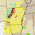
At 7:10, three tornado warnings (red) in the tornado watch (yellow). Flash flood warnings (dark maroon) in western Arkansas. Amber = severe thunderstorm warnings. And, at 7:11pm, we have a tornado indicated by radar south of Little Rock moving rapidly north northeast. People in the red polygon and in the path of the storms should take immediate cover, especially around Parkers-Iron Springs, Sweet Home and College Station. THIS IS MY LAST STORM POSTING OF THE NIGHT.

More on the National Weather Service's Computer Issues

Image
Tonight, we have the following extreme weather conditions as an imminent (i.e., now till noon tomorrow) threat: Tornadoes Damaging thunderstorm winds Flash flooding Mainstem river flooding Freezing rain Coastal gales Wildfires Literally zero visibility causing significant aviation impacts We can mitigate these effects only to the extent that weather science can forecast and warn of them.  So, this discussion is especially timely:  Dr. Cliff Mass of the University of Washington has taken the sorely-needed leadership position in urging the National Oceanic and Atmospheric Administration (NOAA) to fix the mess it has made of the National Weather Service's computing capabilities. Dr. Mass says, I have talked to many people about my blogs and assessment, including meteorologists, both inside and outside the NWS, and highly placed managers and administrators in the NWS:   there is essentially no disagreement that we have a serious problem in numerical ...

Winter Storm Upper Midwest

Image
Pink is a winter storm watch, blue is a winter weather advisory and the green shades are various flood warnings.

First Tornado Warning in New Watch

Image
No sooner did I finish posting the watch for Arkansas, NE Texas and northern Louisiana did the first tornado warning (red) southeast of Ft. Smith. To orient you, Little Rock is at lower right. Yellow polygons are severe thunderstorm warnings for damaging winds. I am not  live-blogging this weather situation.

Tornado Threat Area I'm Most Worried About

Image
The Storm Prediction Center just issued a tornado watch for the area that I believe has the best chance of tornadoes tonight. The watch is in effect from now until 1am CST. Note the probability of tornadoes is "high," the major tornado (EF2+ intensity) is "moderate" and the probability of thunderstorm generated winds 58 mph or higher is also "high." Please keep a close on the weather in these areas. If you live ahead (east) of the thunderstorms and decide to turn in for the night, please keep that weather radio or smartphone app near your bed and have a flashlight handy if you need to dash for shelter.

Tornado Threat Update

Image
Counties in yellow are under a tornado watch, red = tornado warning.

Updates for DFW and Southeast Kansas

Image
Thunderstorms are in the formative stage west of the Dallas-Fort Worth Metroplex. There is a tornado and severe thunderstorm threat later today. Today is "Kansas Day" -- the anniversary of the date Kansas was admitted to the Union. And, the first thunder of the year is rumbling in the southeast part of the state. There is a tornado watch along and ahead of the line of storms.

Ozarks Tornado Watch Until 3pm

Image

Tuesday Tornado Threat Underway

Image
The first tornado watch of the day is out in Oklahoma effective until noon central. I expect continuous tornado watches into tonight as the storms move east. These threat numbers are very high for January. Please keep up on the latest weather information if you live in these areas.

I Like This Guy's Moxie

Image
Anyone who has tried to change planes at Washington Dulles and had to go from the C gates to the A gates knows what a complete joke it is. There are EIGHT escalators, a train, up down and walk, walk, walk. I can hardly imagine trying to do it in a wheelchair. The gentleman in front of me, and he was just that, and I were joking about what a mess air travel is these days. You very quickly forgot he was handicapped. While I never asked his name, I loved his spirit.

Hail and Wind Overnight

Image
The Storm Prediction Center is forecasting an area with large hail and high winds may occur with thunderstorms overnight. And, the Oklahoma City NWS radar at 9:08pm CST shows thunderstorms just starting to develop. They are moving rapidly northeast. This will be the only update on the overnight threat.

Tomorrow's Tornado Coverage

Image
Here is the latest forecast from the NWS Storm Prediction Center from tomorrow morning until 6am Wednesday. Additional severe thunderstorms may occur farther east later on Wednesday. For January, these are very high numbers, especially in the hatched area. Tornadoes and very damaging winds are possible, some of which could occur in darkness. I will post on the threat tomorrow morning and a time or two tomorrow afternoon/evening. However, I will be traveling part of the day so live-blogging the storms will not be possible. AccuWeather has additional coverage .

Why Is the Centers For Disease Control Writing About Tornadoes?

Their article about the Joplin tornado is here . While the following passage supports my contention that siren overuse played a role in the unnecessarily high death toll ,  I was on the couch watching the Weather Channel.  We were having severe storms, which is not unusual for that time of year.  I have heard tornado sirens many times throughout my life living in Joplin, so this evening was not unfamiliar. the fact is that is that tornadoes are not a "disease." We also learn that CDC stores disaster supplies and does disaster planning. While it great for them to plan for things like epidemics, I thought natural disasters were handled by FEMA? If everyone is in charge, no one is in charge. If I recall correctly (changing planes as I write this), this is the fourth of these I've pointed out in the last month, it seems there are many, many overlapping federal plans/agencies. This is why I believe we need a National Disaster Review Board along the lines of the NT...

Tuesday's Tornado and Severe Thunderstorm Threat

Image
While the main threat is damaging thunderstorm winds, there could be a a tornado or two.

Answer to a Reader's Questions About Global Warming

Image
Reader "AVK45" posted excellent questions to my most recent comments about President Obama's climate change remarks . But my question is this: What convinces you that a 1980-1998 type trend won't follow the trend of the past 15 years, which looks awfully similar to 1940-1980? If 1980-98 happened again, what convinces you that we could stop the warming in time? This question is important because the 1940-80 and 1998 through present trends did little to change the overall trend since the late 1800's and the biggest threat from a warmer planet would be sea level rise, not more frequent storms. To begin, please take a look at this annotated graph of world temperatures since 1950. I'm going to take his/her questions one at at time: What convinces you that a 1980-1998 type trend won't follow the trend of the past 15 years, which looks awfully similar to 1940-1980?  You are correct, the current pause/stoppage of global warming does look like cooling du...

January Tornado Outbreaks

Image
With the potential for tornadoes Tuesday and Wednesday, here is an article about winter tornado outbreaks . It is very well done. I personally worked the January, 1999, storms which hold the record for worst winter outbreak. At AccuWeather Enterprise Solutions (then, WeatherData, Inc.) we were shorthanded that day due to illness. So, I had to work one of the storm warning positions. I took Arkansas. The tornadoes were moving with forward speeds of about 55 mph! When a tornado is advancing toward a client at a mile a minute, timely warnings are essential and the pressure is intense. Cropped illustration from article. The tornadoes southeast of the Mississippi River occurred the next day. I sat in that chair for about seven hours without getting up a single time. Fortunately, we got all our clients warned and all were safe; although two of our railroads had debris across their tracks. Few outside of the profession know how intense the pressure is on meteorologists, whether govern...

Ice Today, Tornadoes Tuesday

Image
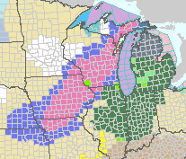
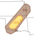
Here are the latest winter weather warnings and advisories. Deep plum in eastern Iowa is an ice storm warnings  where power failures and very poor travel conditions are expected. Purple is a freezing rain advisory. Pink is a winter storm warning for ice. Blue is a winter storm watch. Note: The NWS is working on simplifying all of this and I hope they have it done for next season. AccuWeather Regional Radar shows the area of freezing rain (purple) is moving east northeast at 8:12am CST. There are areas of sleet (ice pellets) mixed with the freezing rain in places. Snow (light blue) is falling from around Green Bay to near Lansing. Once we get rid of this storm, we turn our attentions to a potential tornado and severe thunderstorm outbreak that is forecast to begin on Tuesday and last into Wednesday.  Here are the relative probabilities from 6am Tuesday until 6am Wednesday. Keep an eye out if you live in these areas.

Full Moon Over Denver This Morning

Image
Beautiful shot of this morning's full moon over Denver. You can just make out the moonlight reflecting off the snow-capped mountains. Photo by yours truly.

Sunday Funny: Greeting Card Display

Image
I noticed that when I visited a Hallmark store to select an age appropriate card for a friend of a similar age as me, they seemed to be expressing sympathy about birthdays.

What to Do in a Railroad Emergency

Image
We had an unusual occurrence in Wichita yesterday. A cement truck overturned rounding a corner that happened to include a railroad crossing. As the overturned truck's cab laid above the tracks, a Sedgwick County sheriff's officer dragged the driver to safety moments before the locomotive struck. According to news reports, bystanders ran up the track trying to signal the train, going 40 mph, to stop. While they were certainly well-intended, that not the right strategy. The train's crew might not have known what the bystanders were seeking, plus even if they got a hundred yards or so up the track, that is not nearly enough time to stop. Here is what to do if you ever encounter a similar situation: Every railroad crossing has a signal box (arrow) that provides the power and the electronic circuitry needed to operate the crossing. By law, the railroad's emergency number is painted on the box. That telephone number goes to the railroad's "service int...

Tornado Outbreak in January?

Image
We don't normally associate January with tornadoes so I want to give you this "heads up" pertaining to possible tornadoes on Tuesday and Tuesday night (red) and Wednesday and Wednesday night (purple). It is too soon to provide any more specifics but I'll keep an eye on it and update as appropriate.

Midwest Ice Storm

Image
The purple is a freezing rain (glaze ice) advisory and the blue is a winter storm watch for freezing rain. Over Iowa and Missouri the freezing rain is expected tonight and in the blue areas farther east, Sunday. Note this includes the airline hubs at Minneapolis, Milwaukee and Chicago. In Chicago, the ice expected to begin roughly around noon. In Minneapolis, roughly 1-2 pm. If you are planning air travel to or through these areas, be proactive. Here is my Airline Crisis Survival Guide , the second most popular post in the history of this blog! I also recommend filling your car with gas and getting any essentials (prescription refills, perishables, etc.) before the freezing rain begins.

Hurricanes? Down!

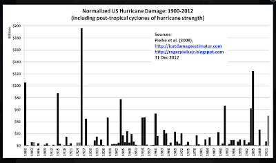
More evidence that there is no upward trend in hurricanes. This from insurance consulting company AON Benfield : The U.S. has gone seven consecutive years without a landfalling major hurricane, the longest stretch since the 1860s, a meteorologist with Aon Benfield’s catastrophe modeler says. But, here is a key statistic: However, despite the slowdown in tropical-cyclone landfalls, global catastrophe losses in 2012 were 36 percent higher than the 10-year average, an Impact Forecasting report notes. The problem clearly isn't more hurricanes or stronger hurricanes. The problem is we keep increasing the amount and value (wealth) of development on the coast -- in harm's way.   Are hurricane damages up? Yep. Is it due to global warming? No. 

Update on Central U.S. Ice

Image
The threat area has moved to the east.  This is the area where significant coatings of freezing rain are likely to occur Saturday night and Sunday morning. Note: The Chicago airports will likely deal with sleet or freezing rain Sunday afternoon and evening. Plan accordingly.

Cessna Aircraft Safety Standdown 2013

Image
Mike was a guest speaker today at the Cessna Aircraft Company 2013 Safety Standdown at the National Aviation Training Center in Wichita, Kansas. In his presentation, CSI: Meteorology-One Man's Quest to Save Lives, Mike describes the scientific innovation that solved the mysterious thunderstorm crashes that were responsible for bringing down jumbo jets in the 70's and 80's. Between the 1950 and 1994, downbursts were the #1 cause of commercial airline crashes. Only after Delta 191 crashed at DFW in 1985, did aviation and meteorologists finally embrace the concept of a microburst as a significant contributing factor in all these airline crashes. After the mystery was solved, Mike was instrumental in helping write the Wind Shear Training Aid that taught pilots how to stay safely out of downbursts. As a result we have gone almost 20 years with out an accident which means 19 potential crashes did not occur and over 2400 lives have been saved as a result of this discovery. ...

Storm Update: 8am CST

Image
Here is the AccuWeather Regional Radar as of 8am CST. The winter storm is progressing as forecast yesterday evening (scroll down). O'Hare is current reporting average delays of 37 minutes.

Followup: My Comments About President Obama's Climate Remarks

Image
Earlier this week I posted my comments pertaining to President Obama's remarks about climate change in his Inaugural Address . I wanted to follow up because of the amount of controversy my comments generated. From Facebook, email, and other comments we have the following typical comment. You are simply wrong on this issue, and it is irresponsible and dangerous for someone in your position of trust to mislead the public into believing that there is more uncertainty with regard to AGW than there is. One, since deleted, predicted I would be responsible for the "deaths of thousands" and ended with a sarcastic "congratulations" because I do not believe storms have increased and believe that, when netted out, global warming will be a small problem. Not a non-problem, but a small problem.  I see nothing that indicates catastrophic global warming is imminent and I believe that adaptation and mitigation make far more sense than trillion dollar (literally) schemes ...

Update: Southeast Winter Storm

Image
We have a variety of winter weather forecast for the region. The plum is a freezing rain advisory which is a lesser condition than the pink winter storm warning in northeast Georgia where a quarter of an inch or so of glaze ice may occur. The blue is a winter weather advisory (the NWS has way too many of these) for freezing rain or sleet (ice pellets) over southern areas and snow over northern areas. Below is a map of AccuWeather's snow accumulation forecast.

Moisture for Winter Wheat Belt

Image
Sunday, I posted that the chances for significant moisture in the central U.S. would improve the week of the 27th. That seems to be working out. Here is the European model's forecast rain (including moisture contained in snow) from now until 6am CST February 3. While things do not improve in the spring wheat belt, some much-needed rain is forecast in the winter wheat belt. From: AccuWeather "Professional" Web Site. Click to enlarge. 

Central U.S. Ice?

Image
The ice in the Southeast will be about as forecast (see below) with, perhaps, a lesser chance of Atlanta having problems. I'll post again on the Southeast this evening. But, another area of potential freezing rain seems to be looming. Of course, freezing rain creates glaze ice -- the worst condition for driving. Here is the probability of 0.01" of freezing rain accumulating between 6pm Friday and 6pm Saturday. The light brown is a probability of 80%. Here is the probability of 0.01" of freezing rain accumulating between 6pm Saturday and 6pm Sunday. Here is the probability of 0.1" (one-tenth inch) of freezing rain accumulating between 6pm Friday and 6pm Sunday: We'll keep an eye on this and have additional postings.

Icy Roads!

Image
A freezing rain advisory is in effect in the purple areas from northeast Arkansas to Mississippi meaning roads could be very slippery in places. That far south they don't have the ability to rapidly treat the roads. The deep blue area is a winter weather advisory in effect for tonight for light freezing rain that may make roads slippery. Finally, the dark green in northern Georgia into the Appalachians is a winter storm watch for freezing rain for Friday and, farthest east, Friday night. Atlanta is expecting a trace to a tenth of an inch of freezing rain. If you are traveling to these areas please keep in mind that conditions will be difficult and traffic very slow.

Lionel Hutz, Call Your Office

Image
Lionel Hutz was the sleezy lawer on  The Simpsons  who was best known for this bit of dialog: [ Homer has been thrown out of an all-you-can-eat restaurant for eating too much ]  Lionel Hutz : This is the most blatant case of false advertising since my suit against the movie "The Neverending Story."  Homer : So, do you think I have a case?  Lionel Hutz : Mr. Simpson, I don't use the word 'hero' lightly, but you are the greatest hero in American history.  Homer : Woohoo!  Keep that bit of dialogue in mind as you read this story of two Jersey guys suing Subway for selling 11.5" footlongs .