How Do We Track Tornadoes?
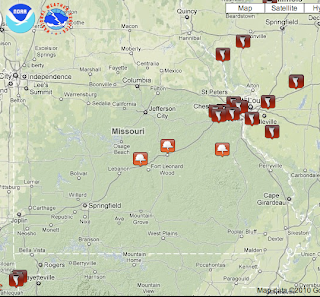
There has been a rash of tornadoes today from the Ozarks to Illinois.
So far, we have reports of five fatalities. That is a tragic number. But, given that the tornadoes began in the pre-dawn hours (scroll down to see the first watch issued at 1:10am) when people were sleeping and that the storms hit densely populated areas well outside of "tornado season," that number is very low compared to what it would have been even 25 years ago.
Of course, Warnings: The True Story of How Science Tamed the Weather is the story of how we learned to "tame" (effectively warn of) tornadoes, hurricanes and other storms so lives could be saved. I thought I'd take this opportunity to give you a taste of how meteorologists do their work while storms are in progress.
The tornadoes that have occurred today have had very different signatures compared with the damaging tornadoes of spring. In spring, the tornadoes that cause significant damage come from large thunderstorms known as "supercells" and the tornado signature is a "hook" echo.
 |
| Fish hook at left and a classic "hook" echo (yellow-gold color near I-80 symbol). |
Today, only a few of the tornadoes were accompanied by identifiable hooks. This is fairly common with cold season tornadoes.
If you have read Warnings, you remember a chapter about a 1973 pre-Thanksgiving tornado in Oklahoma City that occurred without warning. That storm on radar looked like a candy cane. Well, take a look at this echo associated with a damaging tornado in the southwest part of the St. Louis Metro area just before noon:
The question mark or candy cane-shaped echo was moving northeast toward Pacific. The tornado at this time was near Meramec Terrace moving northeast. Because my colleagues at WeatherData knew what to look for, as a result of all of the research of the last quarter century, we were able to have warnings well in advance for our clients in the path of the storm.
But, some of the tornadoes were even more subtle. We had to turn to Doppler radar, which displays the winds inside the storm to see some of the tornadoes.
 |
| No obvious tornado in the conventional radar data. |
In Warnings I describe the struggle to pry loose Terminal Doppler Weather Radar (TDWR) data from the Federal Aviation Administration. Today is an excellent example of why that was a critical battle: The image above, when the tornado was redeveloping near Fenton, had no obvious signature in the conventional radar data. But, on the FAA's Terminal Doppler Weather Radar (TDWR)
 |
| TDWR showing two tornadoes (red circles) in St. Louis County, Missouri |
the major tornado (larger red circle) sticks out like a sore thumb. A weaker, but still damaging, tornado can be seen near Manchester in the smaller circle. With this technology, WeatherData's meteorologists are able to provide precision storm warnings to save lives and property.
What about the National Weather Service's NEXRAD? Because these tornadoes were so small and because of some missing data at a critical time, the TDWR was critical today! So, thank you Federal Aviation Administration!!
The National Weather Service put out effective watches and warnings for the public and WeatherData did its usual outstanding job of providing specialized warnings for businesses. The system worked the way it was designed to.
And, if you have found this interesting, I believe you'll find Warnings fascinating.


Comments
Post a Comment